Our plan after Thanksgiving was to go to Sequoia, but the thermometer took a deep dive there right after the holiday, so we went to the desert instead.
Sometimes (all the time), you should just do exactly what the ranger tells you when you ask them for a two day itinerary for first-timers.
No, the above is not the Dead Sea Scrolls. It’s the Winter/Spring edition of the Death Valley National Park Herald Times Tribune! But with some important notations: first and foremost, scratched out the notice of Artist Drive being closed for repairs. Not yet!
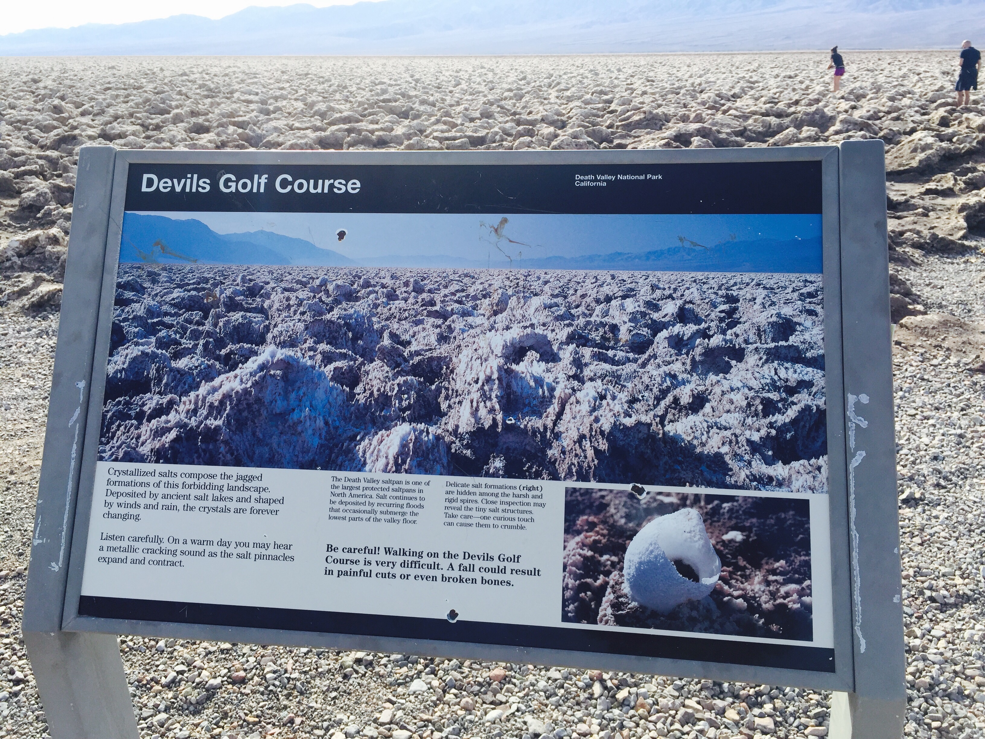
First, we were to go to Devils Golf Course. Definitely not a golf course of any kind. An expansive salty flat to explore – with care!
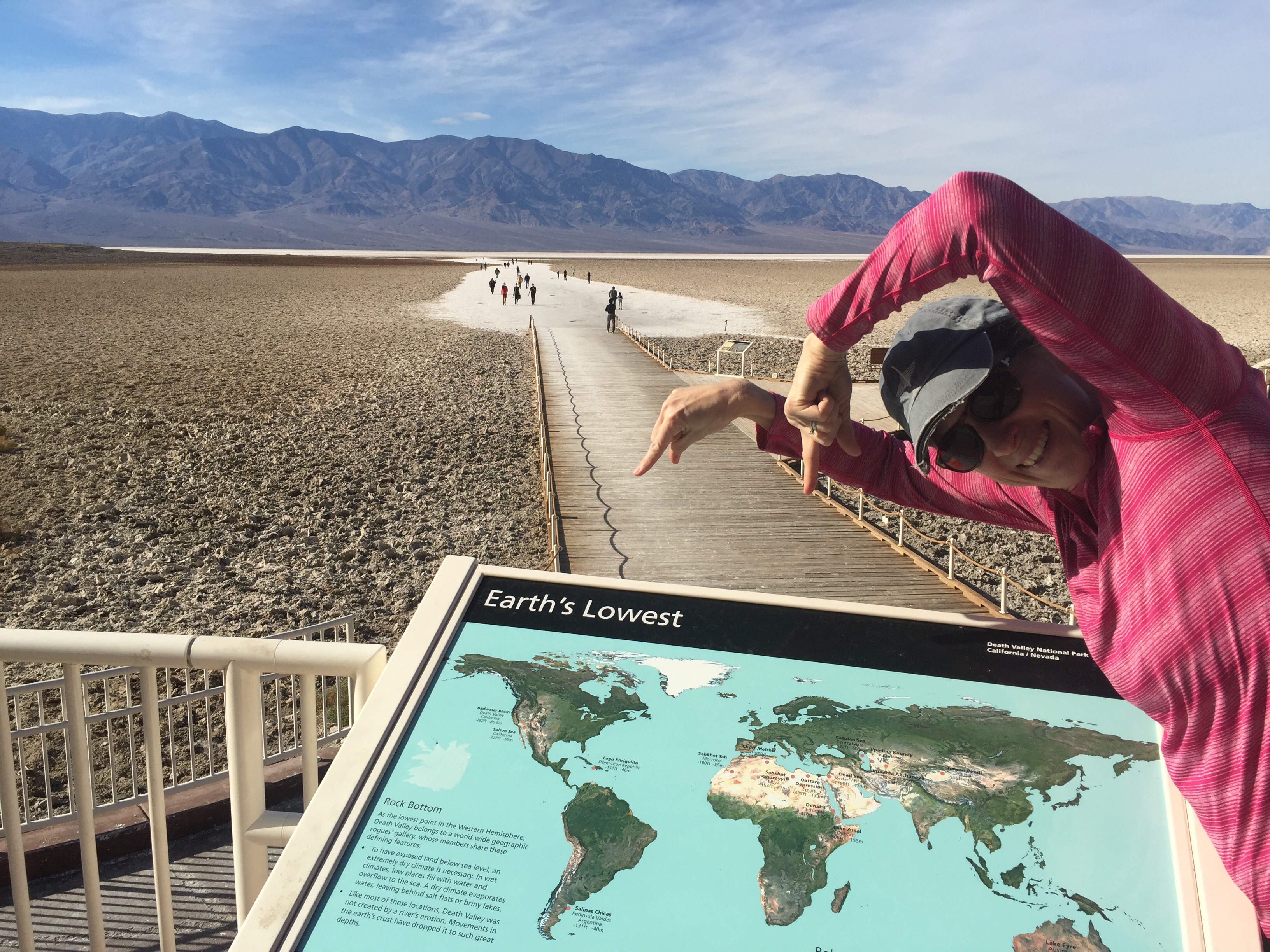
Stop #2? Just a few miles south to Badwater Basin, the lowest point in North America. They have some fun signage to make their point.
This sign – high on a cliff above the valley floor – gives you a good idea of just how low you really are.
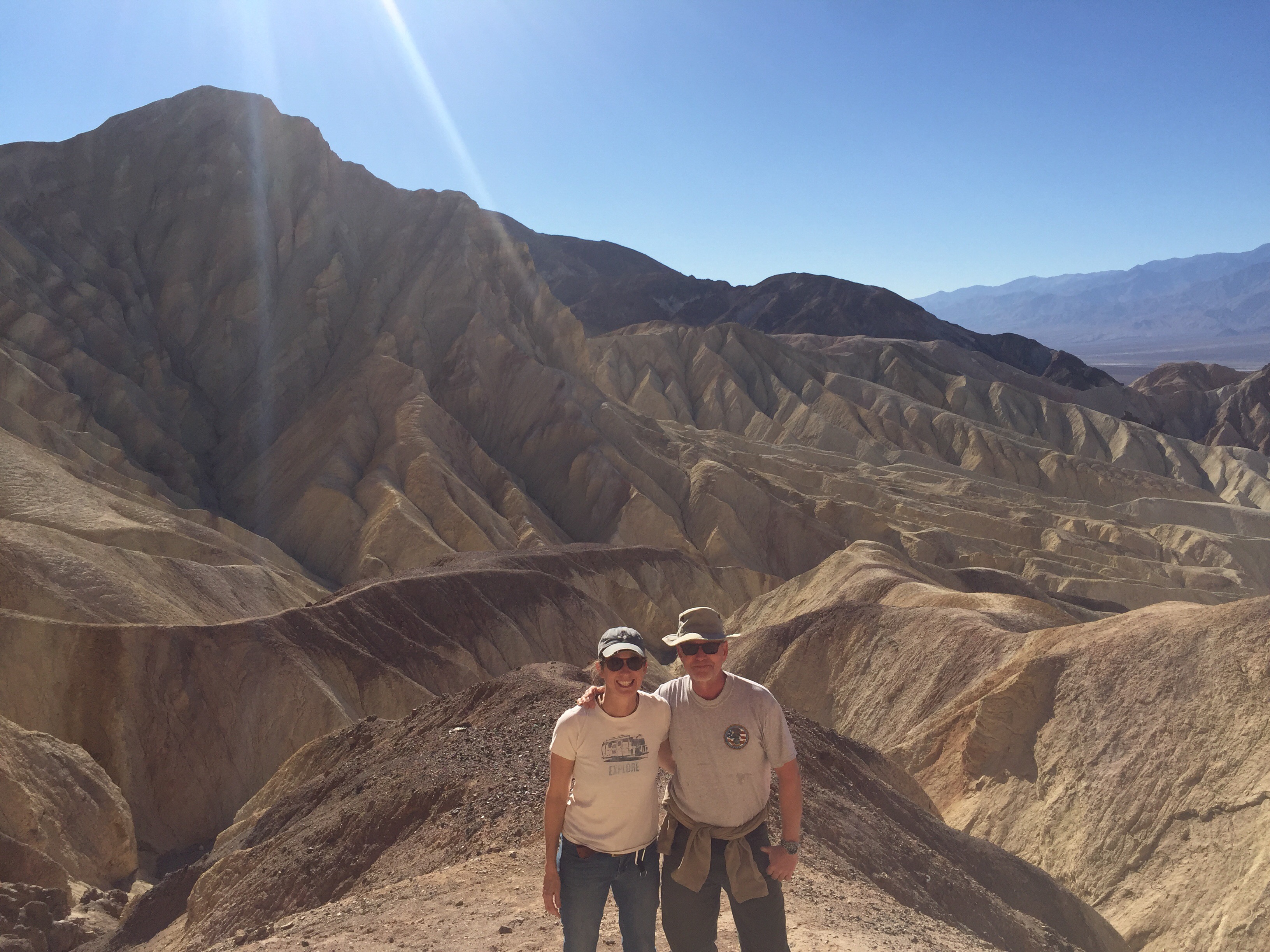
This picture really gives you a sense of the VALLEY, doesn’t it? The Pantamint Mountain Range is in the distance.
Stop #3 was supposed to be Artists Drive, but we had just enough time to make it to the 2:30 pm Ranger Talk at the Harmony Borax Works Interpretive Trail. So what do you think we did?
Above are the wagons of an actual “20 mule train” that was used in the 1880s to tote borax out of the Valley – 165 miles to the Mojave railroad depot. The two wagons carried the borax; the tank on the left carried the 1,000 gallons of water for the thirsty mules!
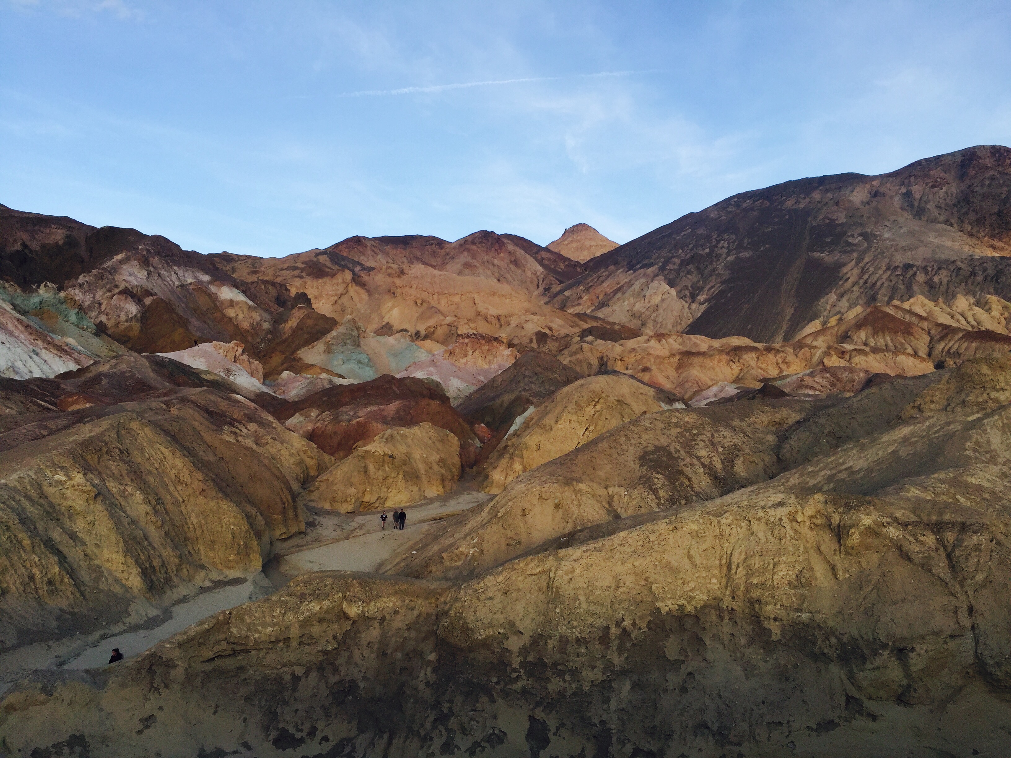
We headed back to Artists Drive – a sort of semi-circular loop through a lovely portion of the valley, the highlight of which is Artists Pallette, a rock face showing gorgeous colors. Sunset was a nice time to go.
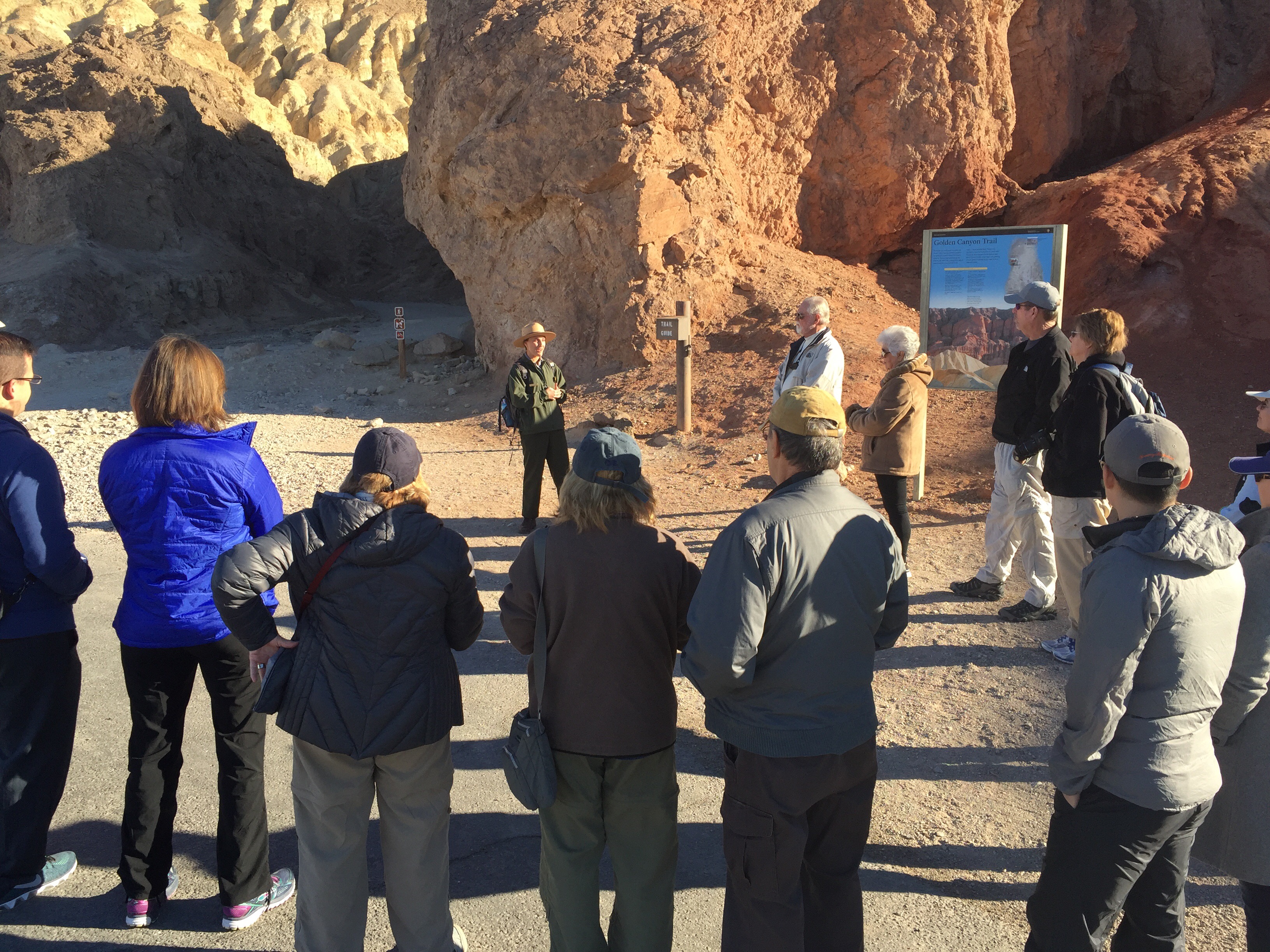
Our ranger had recommended we finish the day with the 5 mile loop hike at Golden Canyon, but we decided to save it till the morning – and we were glad we did. Not only because it was a fairly intense hike – with some fun side trails – but we were able to kick it off with a 9am Ranger Talk. Both talks we went to were lead by Rangers new to the park, but they were both outstanding. Good hires!
Any more questions about why this is called Golden Canyon?
The Canyon talk/walk went about a mile in, focusing on the geology, of course, and in particular the impact water and floods have had on its formation. After, we peeled off toward Red Cathedral, a stunning sculpted canyon that requires some scrambling to get in. We met some folks there who took our picture – and then we played around pretending we were doing a (dusty) Danner Boot ad.
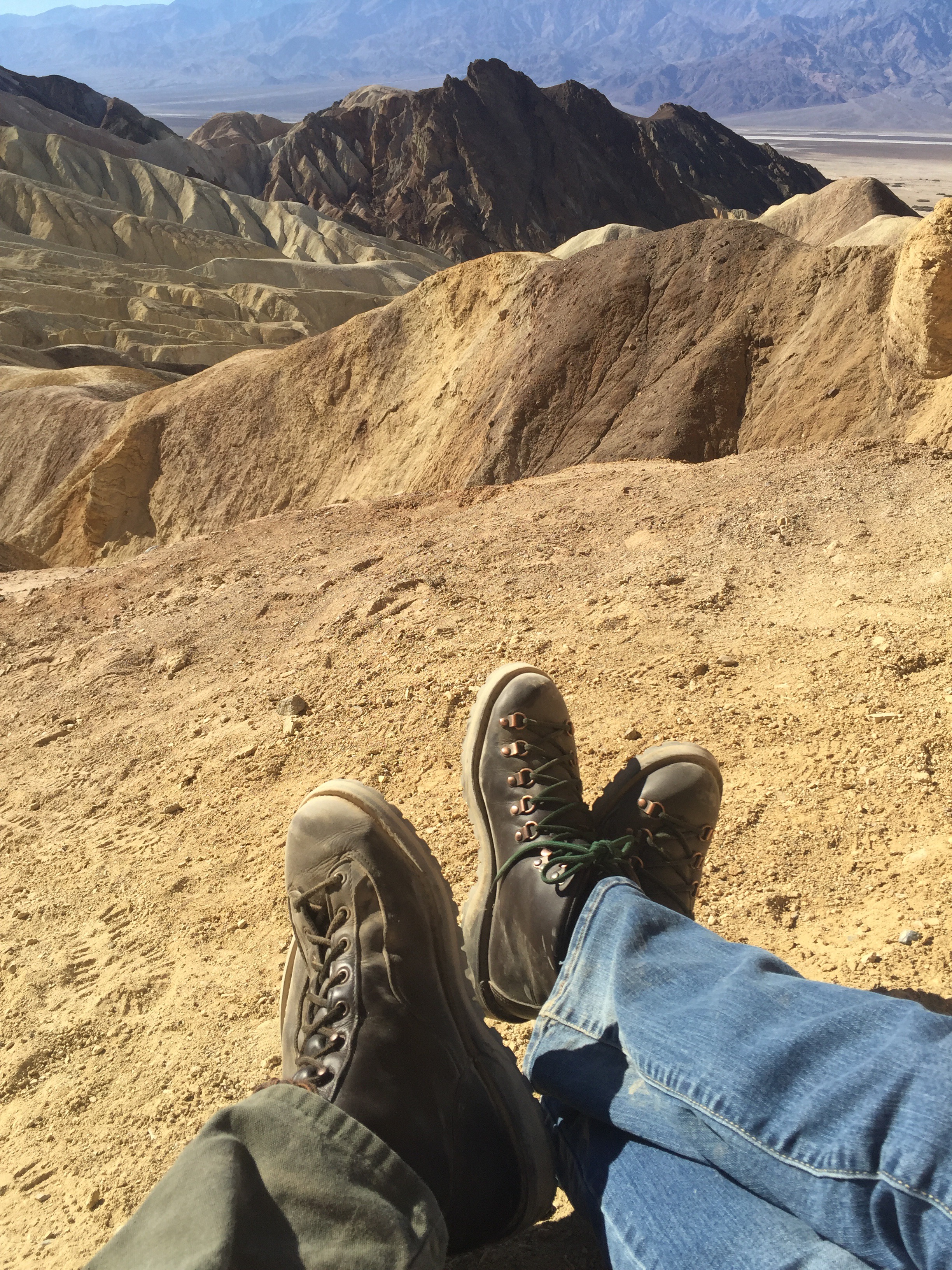
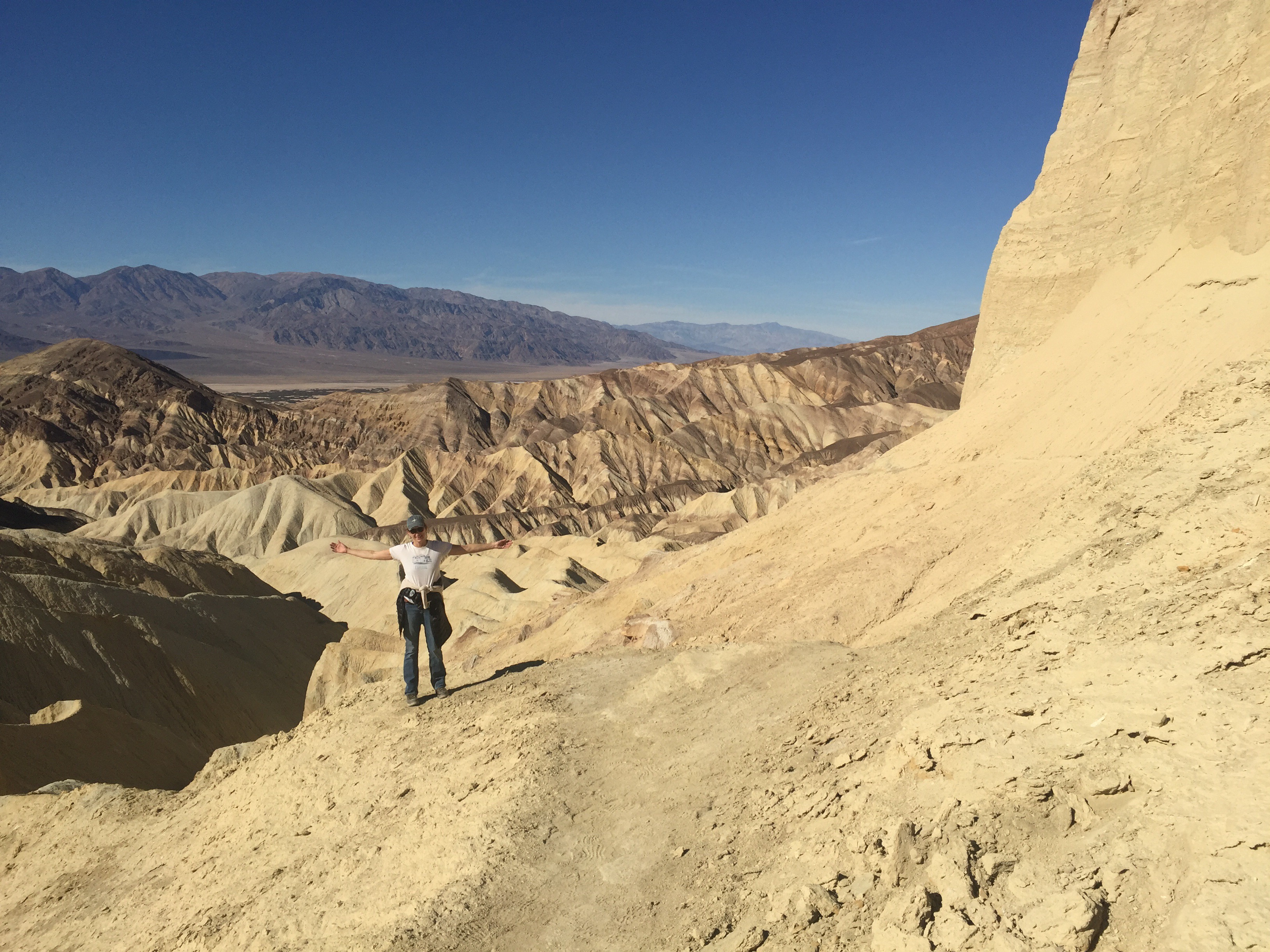
We continued on through Gower Gulch and the Badlands Loop. I’d show you some pics, but honestly it all started to look the same. Maybe I was a little dehydrated? You know how it is when you are like, “Ugh, where’s the car?” That moment is below.
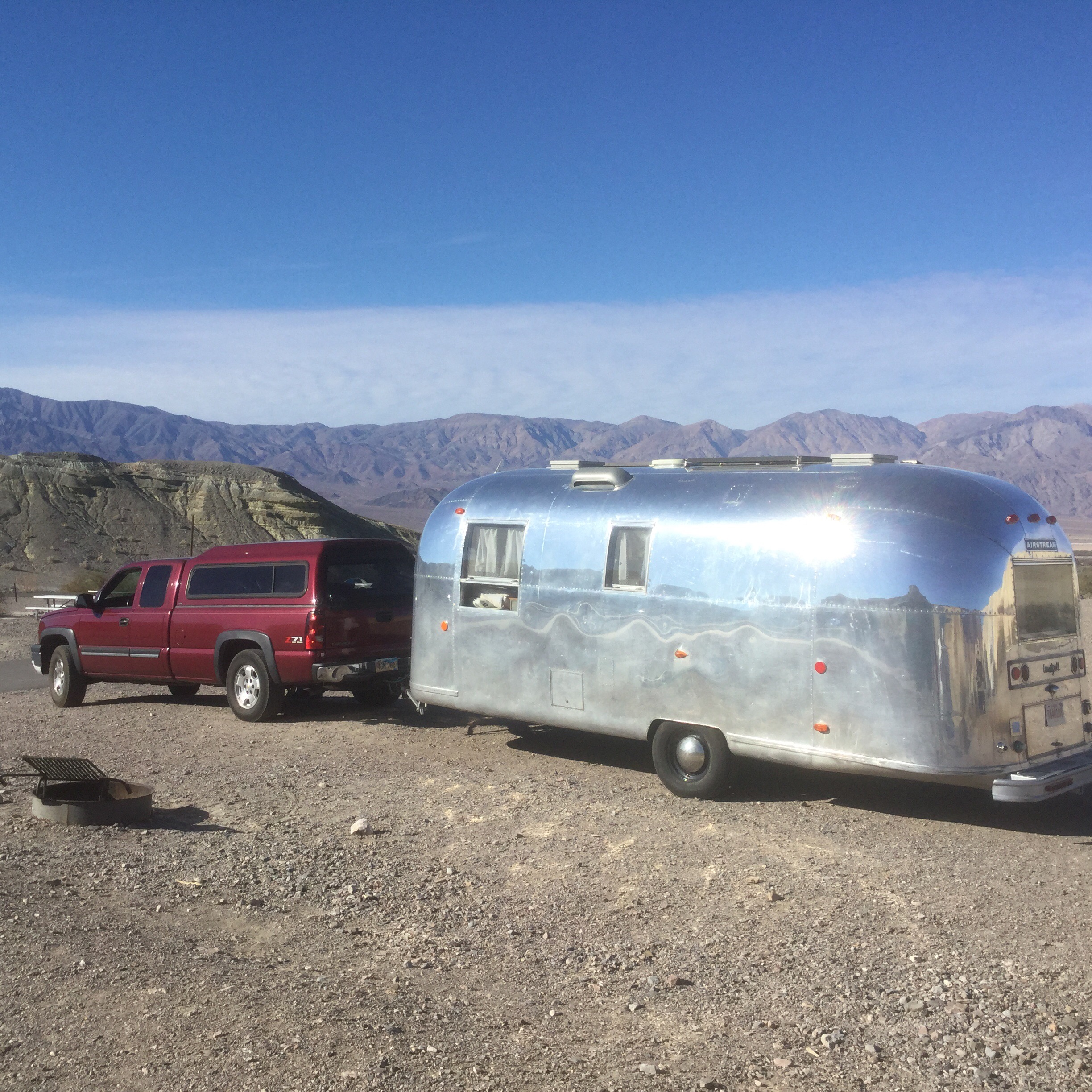
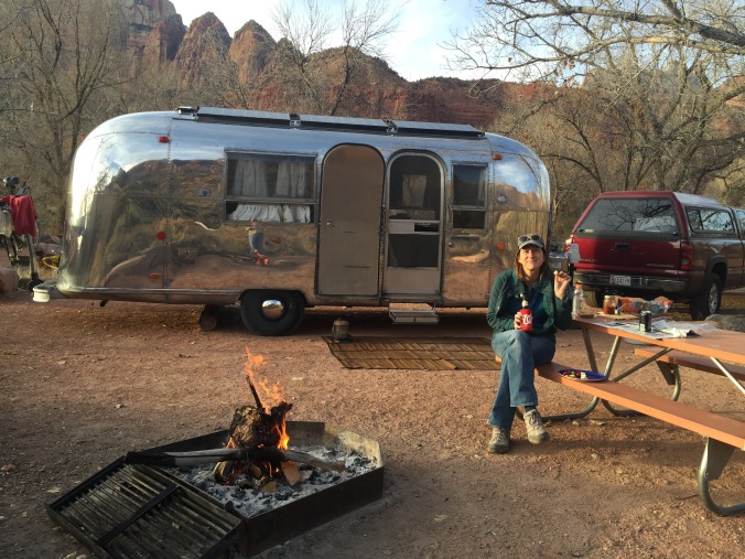
We stayed in Texas Springs campground – an NPS campground that doesn’t allow generators – right in the middle of all these sights. It had been quite crowded for the Thanksgiving holiday we understand, but was no more than a quarter full when we were there. We met some lovely people from Washington state who shared their home-cured salmon with us! And the nighttime skies around our campfire! Anytime you can see the Milky Way is pretty great.
Rangering is only 8:30 – 5, five days a week. So we had 17 sets of “weekends” (my days off were Thursday/Friday) over the course of our summer in Vermont. We didn’t go away for all of them,but most involved at least a day trip, and sometimes an overnight. Here’s a map and a rundown of what we did for the first four!
First – Montpelier! The state capitol. Isn’t it lovely? So stunning and yet so Vermont. The previous state house burned down in 1857 and they went to work on this replacement right away. Some of the original locally quarried granite is still there!
There was a storm moving in while we were there – a bit of an anomaly as it turned out because it was a very dry summer in Vermont.
We had a fabulous YOUNG tour guide who walked us through the beautiful building, pointing out this and that. When we toured the hall with govenors’ portraits, she did NOT have to tell me who the fellow (below) on the left was. We ate dinner at a fairly forgettable establishment, but did find Vermont’s famous because it’s hard-to-find-so therefore-famous beer, Heady Topper.
The following weekend we had a date with Reverend Jack, the Presbyterian minister and WW2 vet/POW who united us in marriage lo this 13 years ago. He goes to Maine every summer to spend a few weeks in Goose Rocks Beach near Kennebunkport, where he was “stationed” at a church for many years, and where he raised his family. We drank martinis, strolled the beach, stalked the Bush family compound, and ate lobstah at Nunans. This weekend will also be remembered for the birth of our nephew Cash – a wee bit early, but all the more exciting!
The next weekend Ben was off on an adventure on his own, so I ventured out on my bike a few miles up the road to hike some of the Appalachian Trail. The AT is a big part of the community here – many locals are “trail angels” bringing food, drink and supplies to spots on the trail for thru-hikers to take as they need. You occasionally see hikers in town, looking for wifi or a laundromat, or a shower.
I really loved my bike-hike combination. I saw/smelled some hikers going south, some going north (nobo or sobo in the parlance). Many of them wisely took a short detour off the trail to get some pie at On the Edge Farm. This little visual treat was along the route for me.
Finally, we did a big trip to New York’s Hudson River Valley – the mansion I give tours in as a ranger is filled with American landscape art. On a tour my first week, I had accidentally identified a Thomas Cole as a Thomas Moran. One of the visitors corrected me via a very polite note left at the visitor center. Ugh. It was time to get smart. Below, the view of the Catskills from Thomas Cole’s house in Hudson, NY. The Hudson River is between here and there. Isn’t it stunning?
For those of you as ill-informed as I used to be, Thomas Cole was THE founder of the Hudson River School of artists. Not a school you go to. More like a group of people with a similar approach – elevating American art in the days when there was no such thing, with a focus on our landscapes. The house had some original furnishings, but really showcased his work habits, routines, and approach as an artist – for example look (below, left) at his notebook showing the different colors for tree bark, and (below, right) his studio. Cole died fairly suddenly, and young-ish in 1848. Respiratory ailment – all that work in studios with stoked fires, handmade paints, and toxic fumes.
We swung west, just about 20 miles toward those Catskill mountains for a short hike to Kaaterskill Falls – a fairly small, but lovely waterfall that just knocked the socks off those artists once they could steamboat their way out of New York City in the 1820s.
One of Thomas Cole’s students, Frederic Church, was born to wealth, but became an accomplished artist in his own right. Both are showcased at his home just a few miles away: Olana. Such a beautiful house, more opulant, inspired by Church’s visits to the near east.
After Cole died, Church helped his estate (cash strapped family) by selling Cole’s paintings. We have three Coles in the mansion, plus the correspondence between Church and the Billings family, negotiating the sale (this was before the days of art dealers.) And now I am proud to say I can tell a Cole from a Moran.
One proud couple spoke their truth this same weekend, the weekend of the DNC. And, because the moment involved a pocket constitution, I screen grabbed it. I just found it among the Hudson River Valley photos on my phone. So, I will leave you with one more timely work of art.
Airstream tucked in at Gilbert Ray Campground, near the Tuscan Mountain District (western) part of Saguaro National Park.
We were both quite taken with this desert, this National Park. All credit goes to Bob, a retired scientist (spent most of his career at the nearby and highly regarded Arizona Sonora Desert Museum) who now volunteers as guide on nature walks in the park.
You know how some ranger talks are better than others? It felt like Bob gave us the keys to the desert – slowly, carefully teaching us about the various plants, one at a time. He explained how they worked together, and how by looking closely, they’d reveal even more about their desert existence, and help you make sense of the place.
Our hero: Bob. In his hiking pack, he carries, among other things, a comb, in case he or a visitor gets stuck by a jumping cholla (choy-a) cactus ball. Also, a camera, because as long as he’s been out in the desert, there are still some things he hasn’t seen (e.g. certain kind of scorpions) and would like to.
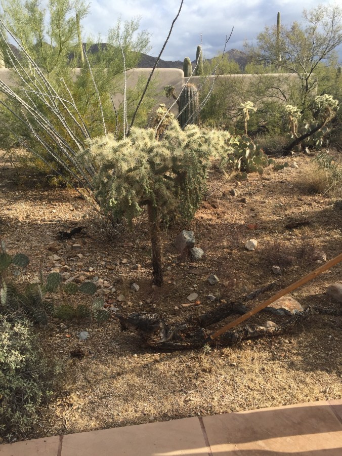
Though the natural focus of the park is the saguaro (pronounced sa – WAH – ro), the iconic Arizona cactus, most often depicted with a few arms lofted to the sky, Bob taught us about other cactus: cholla (teddybear, jumping and staghorn), prickly pear, fish hook barrel. And their non cacti friends: palo verde, ocotillo, mistletoe, ironwood, mesquite, sage.
In this picture, one can see palo verde, saguaro, cholla, and prickly pear. Probably a lot more.
Hover/click on the pictures below for a bit more about each…
A saguaro skelton
A palo verde tree serving as a “nurse” and protecting a baby saguaro
Pincushion cactus
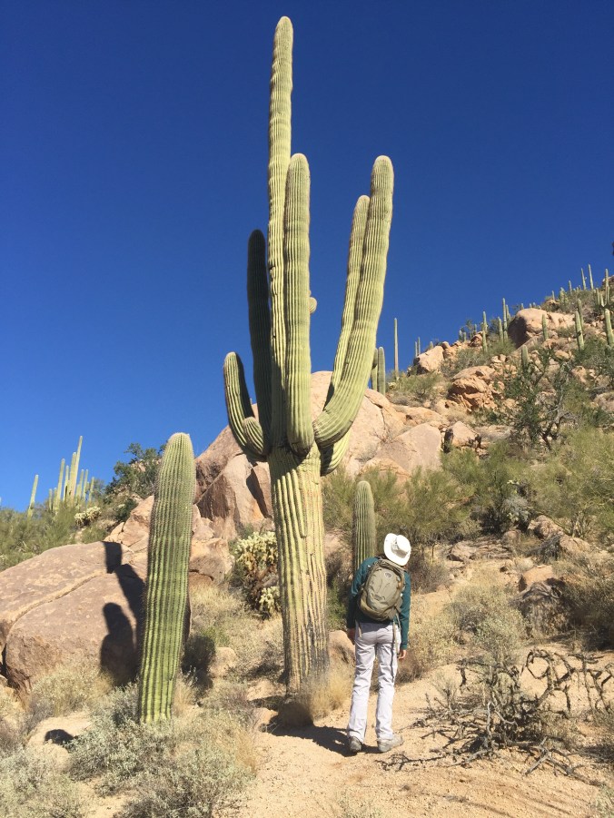
After getting schooled by Bob, we were able to go out and find our own saguaro cacti. On the left, is a younger saguaro, maybe about my age. 🙂 The one I’m gazing up at could be 200 years old.
Ben atop the Hugh Norris Trail, saguaro on his left, ocotillo (which look like a fountain) on the right
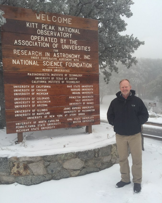
We wanted to check out nearby Kitt Peak National Observatory. It was a bit snowy (Arizona?) so we weren’t able to see any of the telescopes (the paths to them were treacherous), but kicked around the visitors center and had a nice chat with an astronomer visiting from University of Indiana about his work. We would definitely recommend a visit, and a check on the weather at 7,000 feet before you go.
We scratched our astronomy itch instead at a program that the folks at Kitt Peak sponsored, but held in the parking lot of the visitors center back at Saguaro: a night-time Binoculars Stargazing program. Ben and I ended up being the only attendees, so we got a lesson on how to use a star map, tips on using our binoculars effectively, and a personal tour of the night skies. Our guide also gave us resource recommendations for future exploration: download the (free) monthly star guide from SkyMaps.com for a map showing where the starts will be. He also recommended a book for newbie skygazers, young and old: The Monthly Sky Guide, which Santa brought to Ben for Christmas.
Some highlights of what we learned (hopefully translating it correctly):
-There are only 88 constellations in the sky – and they are entirely human creations.
-The North Star – what we know as Polaris – changes. It’s not always Polaris. It’s whatever (bright) star is closest to being directly overhead if you are standing on the earth’s north pole. But Polaris’s position relative to the North Pole is slowly drifting, so eventually (500 years or so) Polaris will no longer serve that role.
-Stars with a blue tint are actually hotter than those with a red tint.
-Ever wonder why your particular astrological sign is in a particular month? Nope, it’s not because you can see your birth month constellation during your birth month. During your birth month, the sun is passing through your constellation, so you can’t see it in the night sky.
We spent a little time in the town of Tucson for some R&R and to do errands. Some of the locals shared that Tuscon is well ahead of other cities -Phoenix, for example – when it comes to things like planning for drought and eliminating light pollution (light pollution is a big deal – affects astronomers, of course, but also animals that require dark skies for hunting, etc.) Tucson is home of the University of
Arizona, and Cactus League Spring Training. We saw the excellent movie Spotlight, and had Korean food at Kimchi Time where I had the very odd but kind of cool experience of having one of the waitresses walk right up to me and say “You look just like my mom! You even dress like her!” Now, as a non-mom, this was a little strange to hear, and most of my friends’ kids aren’t quite as old as this young woman, so that was a little disconcerting. (Plus, what about the “you dress like her” comment?) But she was so sweet, we took pictures together, found some more things in common and are now following each other on IG.
On another personal note, we spent a lot of our time in this spot worrying about one of our kitties, who had/has a health scare, but seems to be doing ok now in the hands of his loving DC family: Laura, Mark, Logan and Finn. But do keep the very handsome orange kitty Gordo in your T’s and P’s.
From Joshua Tree, we motored east to Zion pretty quickly,
spending one night (awesome boondocking) in Nevada, and gathering supplies in St. George, Utah (loved Harmon’s for groceries). Cold weather would be coming later in the week and we wanted to enjoy Zion before it hit.
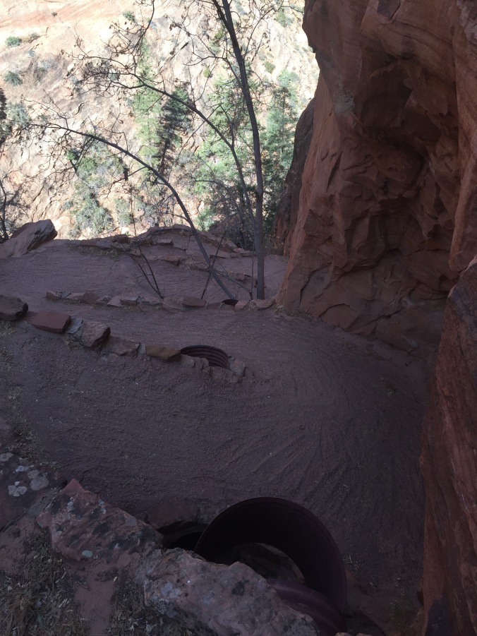
At the Zion entrance, the rangers promptly hopped out to measure the width of our Airstream, to see if we qualified for an “unescorted” trip through the narrow tunnel to Bryce Canyon. (At 91 inches, we just made the cut off of 94 inches!)
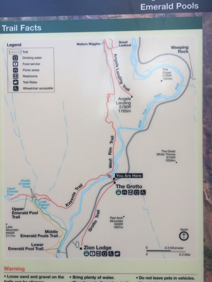
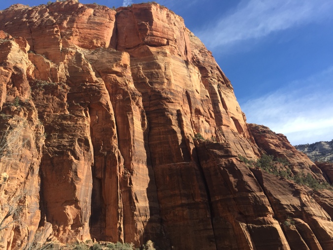
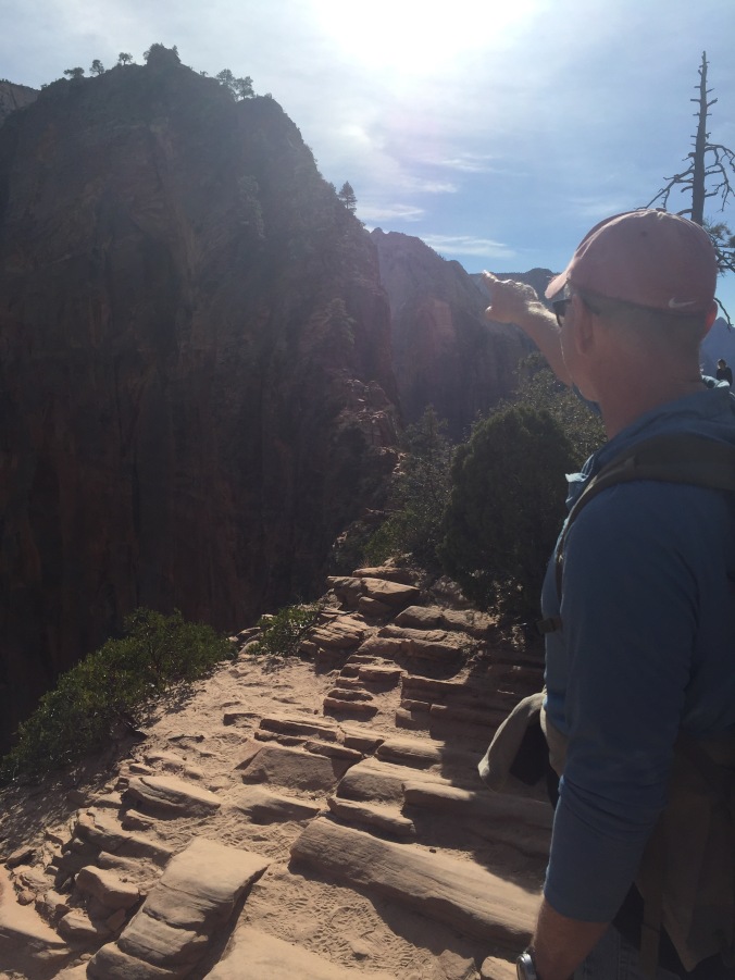
Perusing the information about hikes, we set our sights on Angel’s Landing – a difficult hike but lauded as one of THE very best day hikes in all the southwest. Why? It starts with the West Rim Trail, about 2 miles up a steep hill, then the special part: the Angel’s Landing Trail, a 1/2 mile hike across a narrow rock ridge – also called a fin – with steep drop offs on either side. Chains are installed to aid hikers along the narrowest and steepest parts of the trail. No one has died on it in the last five years or so. Who wouldn’t want to hike this?
Angel’s Landing from below
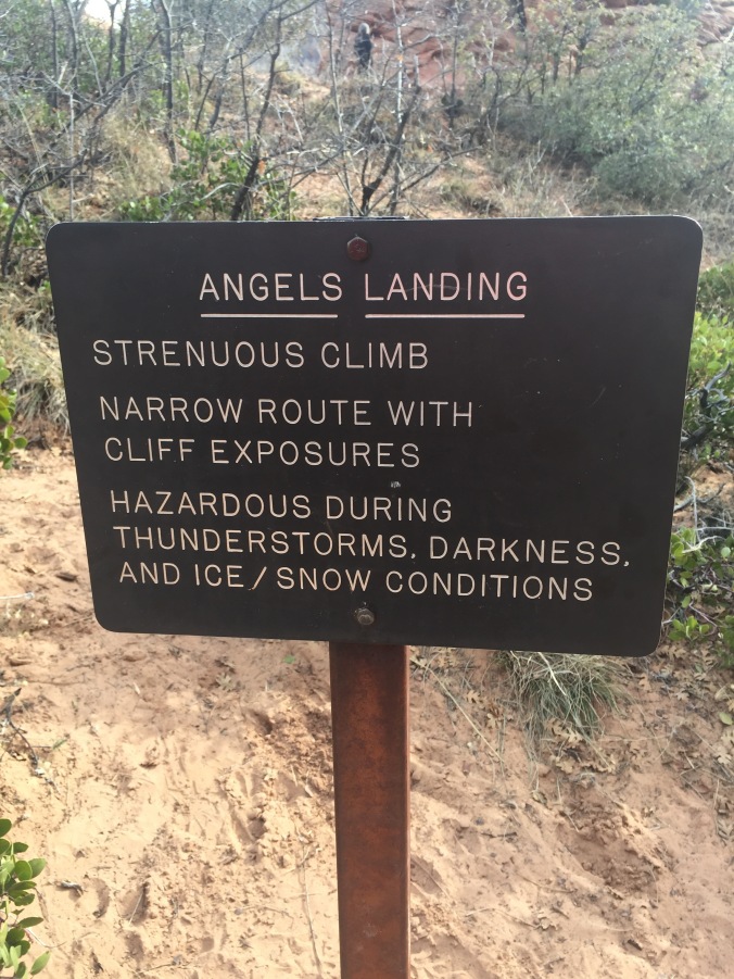
I paid careful attention to the warnings provided by the Park Service and even searched the internet for others. How could a hike that was so perilous also be so popular? Some warnings stuck with me – from the Salt Lake Tribune for example: if you can’t get your footing without the chains, you might not want to hike it. There have been a half dozen or so deaths in the past decade, and the Park Service does not hide that fact, but rather uses it to discourage people. But A LOT of people do this hike. We figured we could too.
One of the signs the Park Service has posted – very well written I think!
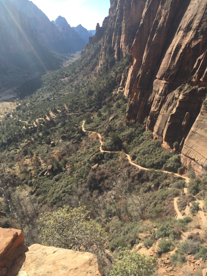
The initial climb up West Rim Trail took us about two hours, just as predicted. We stopped to rest a bit along the way. Though it was December, the conditions were perfect – sunny, no moisture on the trail at all. We maybe saw 10 or so other people going up or down, and 1/2 dozen Park maintenance crew members shoring up the trail at its edges.
Looking back down after we’d ascended the West Rim Trail, but before beginning the scary last half-mile.
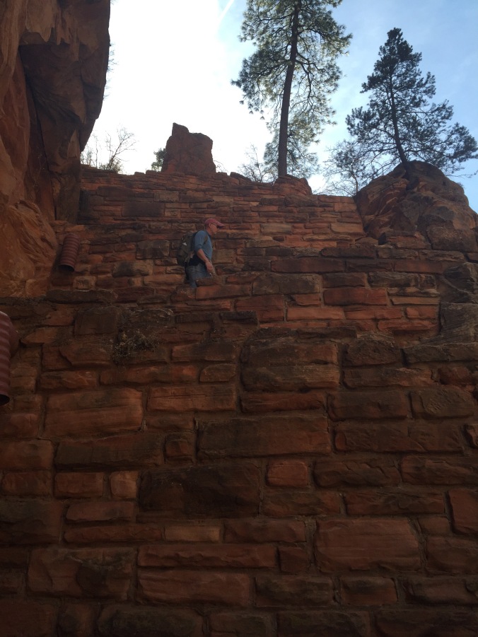
This first section of the hike ends with “Walters Wiggles” (better pic here), a set of 21 switch backs to take you up a very steep part of the trail before the most daunting stretch begins. Apparently they are named for the first superintendent of Zion who designed them!
Ben ascending the Wiggles.
The Wiggles from above.
Now, I have to say, at the top of the mountain, at a place called Scout’s Landing, and before we began that last 1/2 mile stretch onto the actual Angel’s Landing Trail, I had a serious talk with myself about whether or not I was really going through with this. Some of the things I said:
“A lot of folks decide not to continue here. There is no shame in that.”
“It’s going to be tough, physically, but mostly mentally, and I have no problem getting down on my hands and knees if necessary to get across.”
“I am doing this mostly for the ‘I’ll be glad when I have done it’ feeling. I love that feeling.”
“This will be thrilling, and I’ll be totally ‘in the moment’ while doing it.”
“Holy smokes.”
“How often do we get these chances in life? Let’s go!”
Safety first
Early going
The first section builds confidence – it’s steep and narrow in places, but without the sheer drop off inches away. Fairly soon though, I arrived at a critical juncture when I saw what looked like a very, very, narrow tightrope-size ledge strung between the rock outcropping I was on and the one I wanted to get to. It scared me. I felt physically woozy in my gut. How was I to go over that, knowing I’d only have to go over it again on the return? And, to add to my fears, I couldn’t see or plan for what to expect on the rest of the Angel’s Landing trail ahead, so I couldn’t know if I was expending the appropriate amount of courage at this juncture, or if I should save some because I’d need even more along the way. A true dilemma, with not a little pride at stake.
About this time, an older couple appeared, descending the trail and coming toward me – clearly reading my mind. They offered, more off-hand than directly to me – “Oh it’s easier coming down than going up” and “You’ll be glad you did it”. Somehow their words helped, and I am not ashamed to say so did the fact that they were older (most of the other hikers we’d seen were millennials practically running up and down the mountain in toe shoes.) I forged ahead.
This isn’t the site of my point of no return ruminations, but it looks a lot like it. Ben is pointing toward the trail.
Each 100 feet or so is a different challenge – pulling your self up, along side, against [insert preposition here] a rock face, with sure death in the form of a 1,000+ foot drop just inches or less away. It’s not hard to imagine how you could fall – it was more a matter of when.
We were lucky there weren’t more people around – in the summer the path is crowded, and all those people make the trail more perilous. For example, when two or more are holding (and moving) the same stretch of chain, or one is going up while another is going down. (When in doubt on a narrow rock face , go for the hug). Success is found in hopefully a shared belief in the preciousness of life, and a collective fervent but tenuous grasp on it while together on Angel’s Landing. (For the most part people were very well behaved, though we did pass a couple in some kind of argument – lips pursed, eyes stony, heavy sighing, the whole nine, somewhere midway-ish near the tree pictured below.
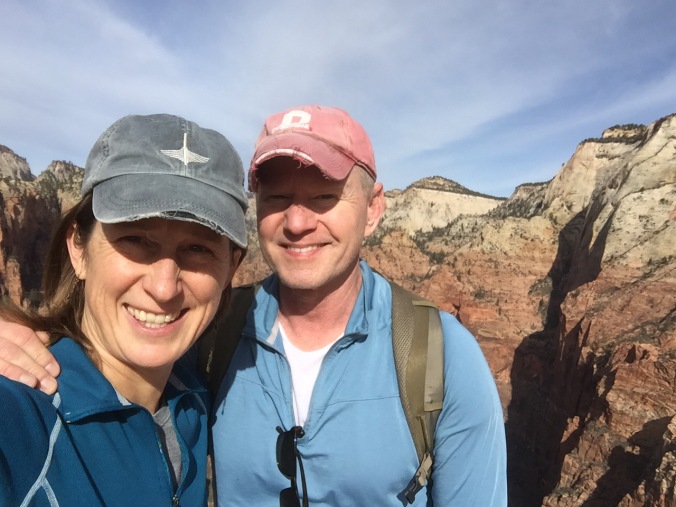
Triumphant selfie, reunited about about midway. Mostly Ben hiked ahead of me and I took it nice and slow.
At another more treacherous point somewhere in the middle, I did gather myself a bit to at least appreciate the fact that while I was “in the moment”, I wasn’t appreciating the views. But the trail was so narrow here, I didn’t dare turn my head, and risk losing balance. So I literally raised my right and left arms just high and quick enough to take a shot of whatever it was I was missing, so I (and you) could see it later.
View to my left…
…and to my right.
Finally we reached the end, a fairly wide rocky plateau with plenty of places to sit and rest and relax and eat lunch, reflecting on accomplishment, scouting for angels. We saw one reincarnated as a chipmunk who persistently hovered trying to catch our crumbs.
Should we have lunch here?
No, this is a better spot
Indeed the trail back was easier, but maybe only because we knew what to expect. As you can see in the pics below, those chains were put to good use by me and my bad knees.
For Ben the way down, like the way up, was more of a walk in a park. Hands in pockets, shades drawn. Movie star cool.
Of course we made it. I had conquered the fears that had cropped up, it had been thrilling, and I was glad to say I had done it. Though Ben thought this image of a hiker tumbling looked awfully similar to how I had deliberately approached the descent.
And finally, nothing says “I defied death and conquered my fears” better than having happy hour outside on the “patio” in December. This one included our very first (in four months on the road) campfire. Cold, but very much in our comfort zone.
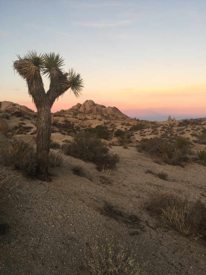
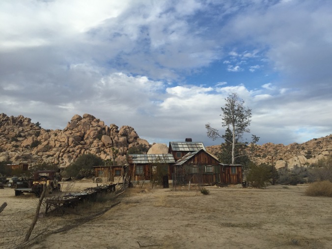
We arrived in Joshua Tree squeaky clean – after spending Thanksgiving at home in Glendale, where we took the time to make a few tweaks, tackle some fixes and a conduct a general “clean up” (of us and the rig). The drive to Joshua Tree was a little over two hours and if you are coming from LA, either the West or North entrances will do. Joshua Tree is small enough (relative to some other NPs) that it’s worth trying drive through and hit all its corners as you plan your itinerary.
We believe we found the best site ever in Jumbo Rocks campground: #77. With an unobstructed vista of rocks and sand and desert scrub, and of course Joshua Trees.
Many of the sites there are tent-sized only, which leads to a good mix of tent campers and RVs (alas they do allow generators here at fixed times). As the sun was setting we took a walk.
Ben and I passed the camera back and forth seeing who could take the best pictures. They are all winners, don’t you think?
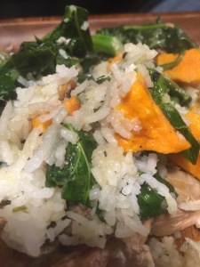
Dinner was all the food I had bought intending to cook while at my parents, but didn’t. You see, if I left it there, my parents wouldn’t eat it. You know? Salmon, collards, rice and sweet potatoes.
Mostly from Trader Joe’s, which, if I had to choose only one place to shop for Airstream cooking, would be the winner. Thank you mom and dad for stocking our fridge.
We watched the Caine Mutiny b/c some scenes were filmed in Yosemite. (Make no mistake, there is no cell service in JT, but we had downloaded it at my parents’ over the weekend.) It was a brief (and corny) scene but otherwise good movie. Got us thinking that would be a fun theme to follow – other movies filmed in National Parks. Any recommendations?
We woke to another sunny temperate day in California – but the first we’d had camping in several weeks! There is really nothing better. Here I am breakfasting outdoors – something we haven’t done in a while. Our breakfasts can get pretty routine, but I love them all: it’s either cereal, oatmeal or eggs. This must have been a cereal or oatmeal day. The only downside is Ben and I have to eat the same thing – due to just wanting to avoid two people in the kitchen, extra dishes, etc. Oh, what we give up to go on a once in a lifetime cross country trip!
We bopped over from the east side of the park to the West Entrance Station visitor’s center, which was small but staffed with super helpful rangers. They also had one of the coolest exhibits I have ever scene – a look inside the creative process behind the design of park PSAs. The PSAs were meant to promote appropriate park behavior to various types of visitors – the ad below is a mock up of the one aimed at campers. The “behind the scenes” revealed the editors wanted to be sure to pick a picture that included a tent and an rv/trailer. I don’t know how well this translates, but the English teacher in me just loved it and hats off to the staff for sharing it. Compare the draft up top (with editor’s notes) to the more final version below it.
After consulting with a ranger, we set a course to do several short hikes as we crossed the park from the West Entrance, past our campground, toward the south entrance. If fact, you may want to start calling us “Short Hike Barkers on Break,” we did so many. Feel free to follow along (from left to right) on the map below.
First up, Hidden Valley. As the name suggests this expanse is hidden behind a ring of boulders. Rumor has it (not much confirmed historical fact in the stories here, but they are upfront about it!) cattle rustlers used to hide out here with their loot.
Can you spot Ben hiding in the valley?
You will see boulders and Joshua Trees, and other trees and all kinds of shrubs and bushes (technical terms anyone?). The walk here, as throughout most of the park, is on sand, like being on a beach. You will see climbers. More of Hidden Valley below…
It was a clear day for the next stop, a drive up Keys View. You can see Palm Springs and the whole Coachella Valley, and the Sultan Sea. Mexico too, they say, but hard to tell. Somewhere down there the San Andreas fault is biding its time. We ate our lunch on a bench overlooking the view.
The view from the aptly named, Keys View
Moving east, we hadn’t really planned on stopping at Ryan Ranch, but the adobe remains can be seen from the road and called to us. Much graffiti and ranch “trash.” Climbers too. Enjoy my artsy pics.
Next stop the Ryan Mountain trail head , not to hike the mountain (a “challenging” hike) but to see Indian Cave – not much of a trail but a cool rock that has campfire smoke from who knows how many eons of campfires.
We met Hash the van-cat there as well. He reminded us of one of our cats, Gordo (who’s orange too).
When we told them about Gordo, Hash’s owners said: “Gordo! That’s such a great cat name!”
They were super hip, so we felt hip too. Not so hip to live with a cat in van though. Don’t worry, the windows were cracked and the temps mild. Shortly after this pic, he headed into the back for a nap while his owners hiked.
Moving east, Live Oak picnic site doesn’t advertise it-but if you drive a bit beyond the picnic tables on the dirt road you can see the growing, healthy live oak (below) for which the site is named. We hiked beyond it on a pseudo-trail and really enjoyed the views and the solitude and the ROCKS. If these pictures don’t convince you to sign our petition to rename this park “Joshua Trees and Rocks” then you are missing the big picture.
Finally, timed for sunset, a bit toward the South Entrance, we visited the Cholla Cactus Garden. You can really see the terrain change on this drive. It’s not gradual. It’s abrupt. And the cacti literally glowed in the sunset while the views of now the Colorado (as opposed to the Mojave) desert mountains were lovely.
The next day we had a lazy-ish morning – Ben hiked around and I did yoga in the sand outside the trailer. I’ve done this a few times now – yoga outside is the bomb; yoga to combat aging muscles that spend a lot of time in the car is the bomb de bomb. From our campground, we hiked to Skull Rock – a popular spot, and sure enough someone offered to take our picture. See how relaxed I am from yoga? You’ll note I am holding my newly re-acquired fanny pack, which, unlike all my jacket pockets, is indeed big enough to hold my phone. It’s getting deployed a lot now.
We had signed up for the afternoon tour of the Keys Ranch. The Ranch sory was interesting enough, but I found the site just very visually striking – these dark strokes of lumber and piping and machines against the Joshua Tree browns and sands and blue sky etc.
And though any kind of private tour seems at odds with the concept of a National Park, it did feel special to be there, and as though the Keys family had just up and left in a hurry, and here we were sneaking a peek. No neat and tidy site is this – it’s the sort of place they’d love to find on American Pickers. Junk everywhere. And the life story of the Keys family isn’t tidy either – for example when asked what Mr. Keys’ profession was, the guide replied “A little bit of everything” which is what it took to survive in the desert. Mr. Keys – actually ended up serving a sentence in Alcatraz – I won’t spoil it by saying what it was for (think Wild West). The oldest Keys son visited the site regularly until he died just this year. He will be interred at the family plot still on site. The tour cost 10 dollars, and is only offered three days a week, though they are popular enough that they will be adding some more. I imagine it’s a struggle for the hardworking public servants at NPS to have to limit access to such a cool part of the park.
The rangers have access to a Library/Archives onsite to help them research and show “past and present” like with this old photo of an area of the ranch.
Afterward, we had time for one final short hike – Barker Dam of course. It hadn’t been heralded in any of the hike guides we perused, but of course we had to go. And it was fantastic! Again, maybe b/c of the time of day. It was flat, with rolling hills and the most incredible site in the middle – a dam that was built and rebuilt by ranchers who lived and grew live things here in the desert!
A close up of the dedication left by the rancher-builders
Ben Barker on top of Barker Dam
More pictures from Barker Dam….
Joshua Tree was a great way to launch our time in the southwest. And, though doing a bunch of small hikes and seeing more doesn’t always feel like the right approach, it worked very well for us at this park. Like the Joshua Tree itself, we avoided establishing deep roots in any one part of the park, and instead attempted to absorb as much as possible through a broader approach.
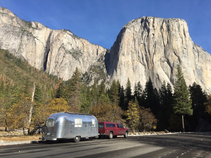
We got two very good pieces of advice before heading to Yosemite, both from friends who we had visited in the Bay Area the previous weekend. One piece of advice was more practical, the other more, shall we say, spiritual. The were both key to to a great, great visit to this gorgeous National Park.
Spoiler alert: Yosemite is A-MAZING!
The first piece of advice was about winter access. Yosemite is in the Sierras. It snows there. If it snows, the park will be open, but you might not be able to get there with your Airstream trailer unless you have chains for your tires. They are very strict, gentle but firm about this. It is in fact the law. You can buy chains (which we didn’t want to do) or you can hope the warming trend coinciding with your itinerary will yield an upgrade of road conditions, allowing you to enter the park without chains. How will you know if the road conditions change? Call this number: 209-372-0200.
Some talented park ranger has to do a new recording every time road conditions change – on the first night of our campground reservations (a Tuesday), the conditions were still “R3” closed to neophytes like us, people driving cars without chains.
So, like the pioneers when they faced similar challenges, we bided our time at a lovely winery. This Harvest Host, Vista Ranch & Cellars in Merced was perfectly situated just a few hours west of the park. In fact Merced was a jumping off point for tourist trips to Yosemite back in the day, and even today, those without a car (or chains) can take a bus from there, or even as far away as the Bay area.
The next day, Wednesday, temperatures were up, that snow was surely melting, and in fact when we called the road conditions line, all had been upgraded to “R2”! You would only need chains IF you didn’t have four wheel drive (we did) and M + S tires (we did). Even still, when we arrived at the west entrance from 140, the so very helpful and sympathetic NPS staff at the gate (clearly reading off a checklist or some sort of matrix) told us that b/c our trailer had its own set of brakes, we would still need chains. Harrumph.
However, a ranger was quick to help us come up with a plan B: book a night at Indian Flat RV Park, about 8 miles down the road, unhitch and head into the park for the afternoon with just the truck. And, assuming all continued to improve, we’d surely be able to get in with the trailer the next day (Thursday). As with the 99% of other times when Plan A has failed, Plan B turns out to be as good or better. Because look who we got to meet at the Indian Cove RV Park? Tigger, the RV park cat.
We quickly unhitched and headed back to the park – we felt like we had been sprung from prison, FREE, as we rolled by the entrance gate, approved to enter with only our 4 wheel drive and M + S tires. We were free to explore for the few hours of daylight left.
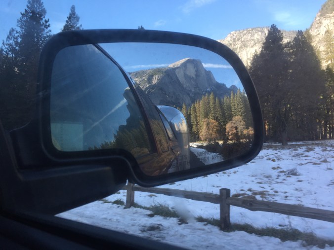
Though I grew up in So Cal, I had never been to Yosemite. I had some sense of what to expect, but was not prepared for the scale of the mountains, their pure granite beauty, and of course the stunning minute by minute changes the rising and setting sun casts on them. Plus there was snow! Melting and slushy mostly, but quite icy in spots too. Happy tourist below – first time in Yosemite.
Yosemite Valley is more or less a loop road – with free park buses that run a continuous loop to all the major sights and trailheads, so once you are in, you are encouraged to park your car and walk, bike or hop on the bus. Most trailheads, and even the Visitors Center don’t have parking lots. It took us this afternoon to figure this out.
But first, we made our way to the Pines Campgrounds, where our reservations, you may recall, had begun the night before. Despite the prominent signage saying “no refunds”, the ranger there was more than helpful in refunding the night we missed, and moving our reservations forward another day. It never hurts to ask.We stopped in the Visitors Center to do a quick perusal – watched one of the movies and came out to a completely altered night sky. Is this what it’s like every night? Wow.
Back at Indian Flat RV Park, we rested up and hoped for the best on road conditions the next day. In the morning (Thursday), as we prepared to drop our quarters in the pay phone to find out, Ben ran into one of the rangers who helped us the day before – he came by on his way into work to tell us that indeed, they had changed the conditions yesterday. We were “R1” and good to go. How is that for customer service? Off season camping rocks.
And we are in!
After pulling in to spot 151 in a nearly empty Upper Pines campground, we immediately set out on the Mirror Lake trail. Recommended by more than one ranger as a good “warm up” hike and one that would not be too icy. Nothing like snow to help you track the wildlife!
Very suspicious. Seen near the dumpster in our campsite.
Note, there appears to be a Mirror Lake photo op, where you can hop off the bus, walk a few hundred yards to the Lake and move on. However the trail is longer, more meandering, a true suspense builder as you go.
But wait, here is where the 2nd piece of advice we received kicks in: from my friend Joan’s book shelf, she kindly let me borrow “Yosemite Valley: Secret Places & Magic Moments” by Phil Arnot. In his Introduction, he lays out some general tips for experiencing the park as more than just a tourist. One that we took to heart was to agree not to talk to one another for certain time periods. “Conversation is distracting,” Arnot explains. In order to have an in-depth experience of the Valley, silence and solitude are key. Now, Ben and I have had some really great conversations on some of our longer hikes on the trip so far, and I realized those conversations were in part borne of the time alone, the quiet, the serenity of the natural environment, the meditative quality of one foot in front of the other on the trail. It really did make me realize how much that same environment can encourage similar results, but within yourself. We were both game to try it and the Mirror Lake trail was perfect for it because there was tons to look at, the landscape was slowly but continuously changing.
This is Ben, practicing non-verbal communication as a part of our pact to hike in silence. He is saying, “Don’t take my picture!”
Most of the first part of the trail was densely wooded alongside a river. Then it opened up into more of an open field (many trees had been toppled) and clear views of those granite mountains. Incredible! Because we had been quiet, I really noticed more. The mix of fall (leaves turning, browns and golds) and winter (icy snow, bare tree) struck me as well. We crossed the river and came back on the other side.
It was about a five mile hike and we were wiped, and it was getting late, toward sunset, and we wanted to squeeze in one more activity. We hopped on the bus and got off at the Yosemite Lodge (for hot chocolate) and walked to the Yosemite Falls foot bridge. It was nearly deserted, and though the iPhone pics don’t do it justice, a lovely way to see the falls.
On the bus again, we got off at our campground stop and the driver called out to make sure we had a flashlight. We did, thanks to Ben thinking ahead but still bumped around a bit among the loops to find our site.
The next day we set out to do a more challenging hike – Vernal Falls. We could walk to the trail head from our site and checked out the Mist Trail on the way- which I understand is packed during high season and was now completely empty. The trail to the Falls was quite icy in spots. We hiked alongside a group of 8th graders and figured if they could do it, so could we! The elevation gains were gradual enough so it wasn’t just a slog, and the views changed incrementally providing something new to look at at every switch back. Again, pictures don’t do it justice. Once we got to the falls, we were up for going a bit further so continued on toward Nevada Falls. We got just to Clark Point and the road closed signs were enough for us to call it quits there. Many other hikers, mostly fellows on their own, hopped the fence and kept going (they had better equipment) but so did a group of three women in their 50s from Korea – one of whom lives near Yosemite now and comes every few weeks to hike.
After hiking down, we explored Curry Village a bit. We saw dozens of people arriving to check in for the weekend. I bought some new sunglasses (I lost mine on the Mirror Lake trail but never noticed it – all that introspection can have its downside) and we found out we could NOT make a last minute dinner reservation at the Ahwahnee for dinner – the super fancy lodge dining option. Probably best as I am not sure what kind of outfit I could have scraped together.
The dining room was closed for a private event but I snuck in and snapped this picture. I have yet to have a fancy dinner at a park lodge. 😦
We ate at their bar instead – it was nice to get out for the evening, but I would not recommend it – sort of like eating at a chain hotel restaurant, but worse. Sorry to end on this negative note, but gotta keep it real.
The next morning we gifted our new neighbors the Schmidts (tent
We don’t know what to do with this.
campers who arrived from the Bay Area sometime around 130) the firewood that had been gifted anonymously to us when we arrived (we have yet to have a single campfire) and headed out to make our way to LA for Thanksgiving.
We took with us a fair amount of Yosemite mud on our hiking boots, and smiles for all the arriving weekend visitors who’d enjoy unrestricted access to the park roads and perhaps a few less road closed signs on the trails as the temps remained moderate for another off season weekend.
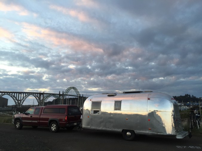
We have gone up, down, around, and through Oregon on this trip. 10 days on our swing north in September (read about some of that here, here, and here, another 10 days on our swing back south in November. Though, embarrassingly, I included the first night of this second leg in Oregon in a post about Washington state. Sorry The Dalles!
Having visited Portland, Willamette Valley, and some of the coast about 10 years ago, we were pumped to revisit some of our favorites and find some new places to explore as well.
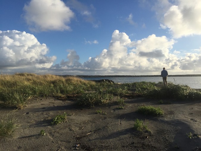
We’d been to Astoria before – a neat, real (not just a tourist) town on the coast, at the mouth of the Columbia River. Astoria welcomed us back with a beautiful rainbow!
We stayed in Ft. Stevens State Park – and got lost looking for the campground, but as usually happens once you get past your annoyance at the GPS, our wrong turn led us to some beautiful sites and we took a walk around the jetty.
The main thing we wanted to do this go round in Astoria was visit the Ft. Clatsop National Historic Park, where Lewis & Clark wintered over after completing their westward journey. The Corps of Discovery did not enjoy their time there — it rained a bunch — but we did especially because the park had been closed due to a fire when we here 10 years ago. We don’t have any pictures (!) but we do have this video we made there because our visit coincided with our nephew Carter’s birthday. It also just goes to show if you didn’t get that card in the mail on time, with a little creativity and the wonders of technology, you can do something cool to make up for it.
We rode our bikes to Ft. Clatsop – it was a little further than I thought it would be, on some busy roads too, but I would still recommend it. I don’t know if this is novel to anyone, but when I am low on batteries or data or coverage, I take a screen grab of my route and refer to that as I am able.
The museum and site were very good. The replica fort (seen behind us in the video) was smaller than I thought it would be – you get a real sense of the Corps just hoping to – I dunno – maybe stay warmer by being so close together? Having less of an area to defend in case of an attack? I appreciated the attention to the long term fate of each Discovery Member in the exhibits, especially York. In the evening we treated ourselves to dinner at the the Bridgewater Bistro in Astoria. The food was only pretty good, but because the service and the setting were so spectacular, we’d recommend it. They let us combine two desserts into one – a chocolate brownie with coconut ice cream. And the crab cheesecake appetizer was excellent.
On the way out of town, I stopped in the small but lovely Astoria Co-op, while Ben waited in a very long line to get his haircut at the Eleventh Street Barber. He passed the time by chatting it up with some local Coast Guard fellows, and I was amused by the proprietor who kept offering everyone cold beer from the mini fridge.
After a quick trip back to Seattle for some “admin” and a chance to visit dear friends in Auburn, we spent one more night in Washington – at an Airstream park, the aptly named Washington Land Yacht Harbor. The Park was pretty basic and they’ve opened it up to non Airstreamers (but if you are WBCCI members, there is a discount). There is also a fairly large brick and mortar home community surrounding the park – only requirement is that you must own an Airstream to buy a home there. We chatted a bit with one of the residents about the history of the park — folks with a common interest coming together to build a community — and the ways they are working to keep it going today. We made a quick stop at the Olympia Farmers Market (get the cinnamon bread from Wagner’s and any jam from Johnson’s Berry Farm) and the state capitol (pics below) before we recrossed the border.
Any resemblance?
Capitol interior
On to Portland! My friend Tom and his wife Julia about 10 years ago got to pick anywhere in the US to live after many years in NYC – and they picked Portland. How hip they are! Tom may not have known what he was in for when he said “You can park in front of our house!” on one of my Facebook posts tracking our travels, but regardless, we were “all in” as guests (though they were lucky we had just done our laundry in Seattle!)
Tom indeed had a lovely place for us to park in front of his house
After an afternoon of chatting and catching up we had a great dinner out – we wanted to go somewhere “Portland” and we knew Julia picked a good restaurant when the waiter assured us their pork come from pigs that are “pumpkin fed”. I couldn’t remember the name of the restaurant but just found it by googling all the things from their eclectic menu that I especially liked: “short rib sushi bread pudding” – and it was the first hit! Pono Farm Soul Kitchen in Northeast Portland. Yum.
We had a fortuitous meeting in Tom’s kitchen the next morning over coffee and cinnamon bread – his friend Stuart came by and once we realized he was a guru on Oregon travel, we asked and he gave us all kinds of tips on where to go, in what order, via what road, down to which Dairy Queen was the best in the state and how to work in a side trip to the town where some of Animal House was filmed. Not only that – he told us his mother grew up on a farm near Eugene, his sister lived there now, and would we like to park the Airstream there? Yes!
Following Stuart’s tips, we headed south to Willamette Valley, via Oregon City, the final stop on the Oregon Trail. The VC there is a bit pricey, and at this point we maybe felt a bit overloaded from other related sites we had visited but it provided nice closure to that theme of our travels and a good photo op or two.
Exterior of the museum depicts – a wagon!
The museum had kid friendly exhibits which Ben enjoyed too
The plaque: “End of Oregon Trail”
We headed south into Willamette Valley, to our Harvest Hosts Kramer Vineyards near Gaston. Though they were having an event that night – they couldn’t have been nicer and more accommodating to make room for us. We arrived just in time to jump in for the heritage vertical pinot noir tasting – basically tasting the same vintage, but from six different harvest years. Their thoughtful placemats (below) explained some of the differences in the rainfall, temperature, harvest date, yield, etc of each year. The owners encouraged us to sip, take notes, let the wine breath some more, repeat. It was awesome – I appreciate good teaching and this was it! We were seated with this really nice couple who are wine club members there and were so generous as to cover our tasting bill as part of their guest allowance. I know this is not exactly like the kind of generosity Cheryl Strayed writes about receiving on the PCT when her 20 dollars didn’t arrive and she wanted a Snapple, but we were very appreciative nonetheless! We even bought some Pinot Gris to go – in a growler! – so though the wine is gone, we have a very nice souvenir of this visit.
Next we headed west to the coast, and an overnight at Nehalem Bay State Park, complete with another rainbow and the best walk on the beach yet. We made some excellent lentil soup here which we ate while watching “Waiting for Guffman”. (Not wanting to use our data to stream, we pick up old DVDs wherever we can!)
On the way south, we stopped to do the Cape Trail at Cape Lookout State Park. This trail is truly fantastic – gets you out, as the name suggests, on a cape, with gorgeous views of the Oregon Coast. The hike was fairly flat but with some difficult passages due to mud, rain, general dampness that was the weather for much of this leg of the trip. But fantastic hike – highly recommended for coast lovers. Before the trip, I had surgery to repair an ankle ligament tear and I take pictures like that in the lower right to send to my surgeon some day as a thank you.
On to Newport, where an excellent Wheelingit blog post about free or cheap(er) camping on the Oregon Coast led us to the Port of Newport Marina. We always enjoy a marina, though the dry site parking area was adjacent to the Rogue Brewery warehouse and a few semis kept their engines running while resting there at all hours. But the view (below) couldn’t be beat.
Yaquina Bay Bridge just south of Newport, OR, in our dry camping spot at Port of Newport Marina.
We walked a hundred yards to have dinner at the Rogue Brewery Pub that night – the food was excellent! Try the crab kimchi sliders appetizer for sure. The next morning we walked a few hundred yards and forked over the big bucks to explore the Oregon Coast Aquarium – click on the link to see the best URL ever. We don’t begrudge museums entry fees, but it always feels a bit of a risk. In this case, it was well worth it. The Aquarium has more than a little bit of everything including live animal feeding demos, a walk through a shark aquarium tunnel, and thoughtful exhibits with volunteers and staff who were very good at their jobs answering questions, sharing what they knew and passing on a respect for the natural world.
This volunteer with the puffins was so knowledgeable and knew just how to engage her audiences.
The pelican exhibit stage had recently been enlarged so the staff are painstakingly familiarizing the animals with the new space.
Otter feeding – all maies – they compete to be the alpha (I heard from the puffin volunteer.)
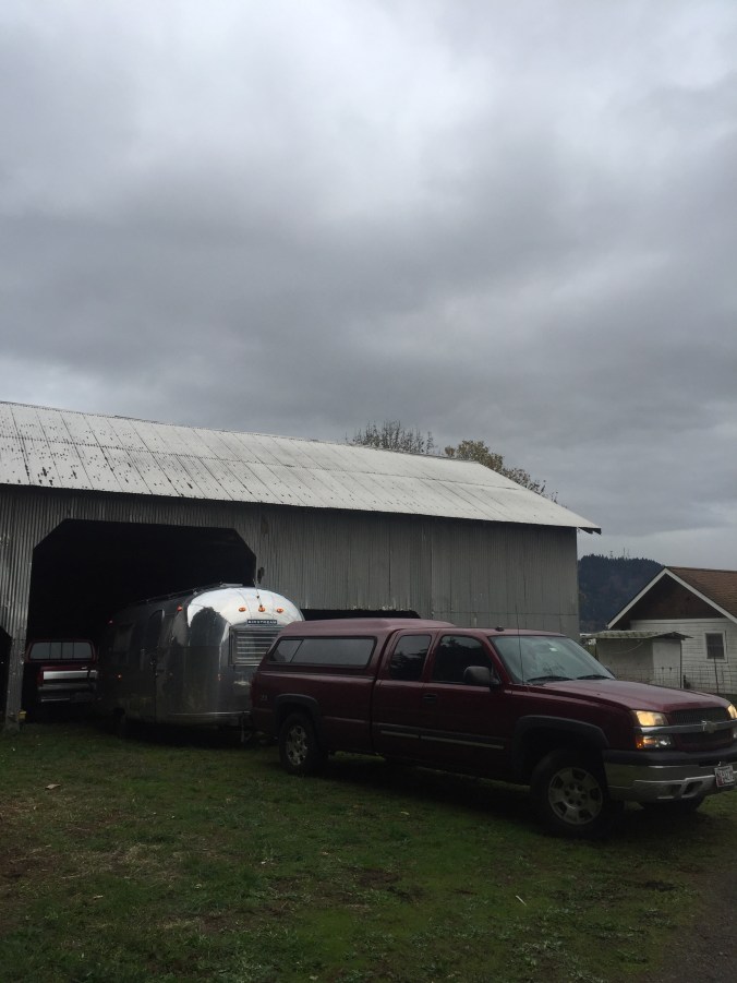
We headed east to Stuart’s sister’s house – the Hurd family farm. The barn – 100 years old–was an awesome setting and we enjoyed our neighbors, sheep, chickens and rooster.
The next day, I headed into Eugene. It’s always fun to check out a big college campus and University of Oregon was lovely. I checked out Hayward Field – home to track and field legends – and their art museum, which had a cool exhibit on post war Japanese prints. As I walked across the same type of criss-cross quads I traversed as an undergrad, I caught snippets of conversations among the students – worries about how to bring up a grade (this from someone on a cell phone), wishes to check out new restaurants (or food trucks), a mission to return some rain boots. Though so much has changed, so much is the same.
We finished off the state with a visit to Ashland, home of the Shakespeare Festival for most of the year, but not this month. I did a quick hit of their downtown to do a little shopping of my own, of course visit their very large and very good Ashland Co-op and scout out restaurants for before a concert we were heading to that night. As we winded down this first leg of our trip, it seemed we still had some work to do to check out the night life / cultural events in the places we visited. This (left) folks/bluegrass/orchestral mix of groups was right up our alley. They even had a hammer dulcimer! One of the leads, Emy Phelps, is from Ashland, so it was a homecoming event for her. A highlight was when they brought all the local (about 20 kids) young violin students up on stage with them to join in for one of Emy’s songs. The parents especially loved that because all those hardworking novices sounded so good in harmony with the professionals. The whole vibe was about collaboration and education, a mix of young and older, lots of smiles and great music! Culture and nightlife – check!
I’ll end with a scary story (with a happy ending) and a cautionary tale. On our drive to Astoria on I-84, we encountered what was without a doubt the scariest moment driving and the closest we’ve come to an (what would have been awful) accident. We are cruising along in the slow lane, and the first we saw anything, the semi in front of us came to a screeching halt and Ben reacted, braking hard, slowing us down, with one hand protectively on me (I think he was trying to keep me from screaming as much as from slamming into the dash) as he very very calmly and slowly said, “OK, I am not sure we are going to stop in time.” Yikes. Hold on, hold your breath and watch the road between you and the 18 wheeler in front of you slowly disappear.
We did stop in time though, with a few feet to spare, but then of course the worst was still to come as we waited with stiffened backs to see if any cars behind us would slam into us (and the Airstream!)
This was NOT the truck/appliance that nearly caused us to crash
As Ben looked left, trying urgently – without success for a long minute or two- to look for a spot to merge into the fast moving traffic and get moving, I leaned right and saw what was up: someone had been carrying a range stove in the back of a pick up and I guess it wasn’t fastened down well, because they were now moving the oven from the road, back to their truck. Oh my gosh. And still we were at a dead halt on a four lane highway.
Once it was out of the road, the truck ahead of us quickly got going, and so did we, still worried about getting rear ended until we got some speed going. We thanked our lucky stars and made an appointment to get our brakes checked (though they got us out of this jam, just for peace of mind.) When I told my dad this story he asked if I got a picture of the oven in the road and I said – no, darn! – so I snapped this one (above, right) on the road a few weeks later…pretty well battened down, but not something we’d choose to drive behind. So – watch the road for flying appliances (you probably are already, though).
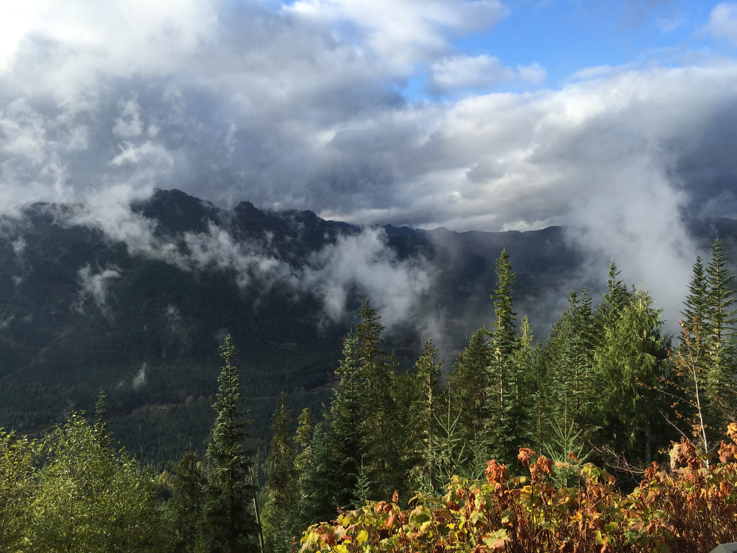
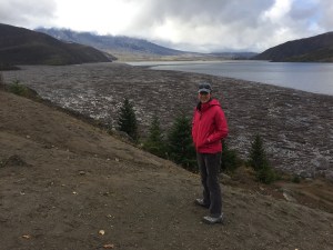
We spent a lovely long weekend in Seattle with friends new and old, enjoying our first days in a REAL bed since our trip began almost two months ago. We headed to Mount St. Helens – that perfect mix of history, nature, and places we might never get to in a world of limited vacation time. Though we’d heard enough from Seattle-ites about the wonderful precious mountain views that only come “on your tiptoes during full moons when the breeze is blowing just so, and a black cat hasn’t crossed your path, etc”, we were pretty blown away by this view of Mt. Rainier on our way out of town, south on 5. A foreshadowing of spectacular sights to come…
Mt. Rainier, on a unusually clear day, heading south from Seattle on THE 5!
Soon we were in the land of volcanoes, many active in the Cascades region (being so close to those Pacific faults you know), and one famously so 35 years ago, Mount St. Helens. Though we both remember the eruption, we don’t remember that there had been plenty of warning (seismic, geysers, a bulge on the northwest side that grew five feet(!) a day) that a major volcanic event was coming, and that somehow made the human story behind what happened here even more compelling today. The weather held and we were greeted with this view when we arrived at the Visitor Center at Silver Lake. It’s in an area northwest of the mountain which was devastated by the eruption. The exhibits there focus on the impact on the local community.
The staff there suggested (thankfully!) that we hightail it to the Johnston Ridge Observatory — about 50 miles west — for a closer look at the mountain and to take advantage of the spectacular visibility, which weather reports suggested would not be coming again any time soon. Plus. the observatory is only open seasonally and closing in a few days. We made plans to return to this VC the next day and headed up the mountain.
About halfway up to Johnston Observatory – elevation not too bad for towing the Airstream but these viewpoints are convenient to give the truck a rest. I believe the snowy peak to the left is Mt. Baker..
Johnston Observatory , 5 miles from the summit, is named for David Johnston, a 30 year old (!) volcanologist working with the U.S. Geological Survey (USGS) who died in the eruption. He is credited with saving hundreds/thousands of lives because of his warnings about the danger based on the readings off the mountains they were getting in the weeks and days before May 18th, 1980. Though the area around there isn’t widely populated, it is/was a popular summer destination, with cabins, lakes, camping, etc. Police had set up checkpoints all around keeping people out on the advice of people like Johnston. You can imagine, especially with the run up to summer, the pressure from residents, business owners and others. This exhibit panel to the right from the Silver Lake Visitors Center tells some of that tale.
The eruption itself happened on a Sunday morning, at 0832. The day before, police had escorted anxious property owners in and out for quick checks and to retrieve belongings – folks had been barred from visiting their homes since March, when the first eruptions occurred!. Officials were planning to allow homeowners to briefly return again on Sunday. That morning, David Johnston was at his observation post, located about where the Observatory is today. His final recorded words came as he urgently radioed USGS headquarters in nearby Vancouver, WA …“Vancouver, Vancouver, this is it!” The eruption began as a lateral eruption – just like it sounds – the mountain blew up sideways. Because it is so unusual, it was unexpected, even to the scientists. These pictures were taken by a camper who just happened to have the perfect vantage point – and hightailed it away with his life. We camped here the second night.
From Bear Meadow pull-out off 99 on the east side of the park. Pictures taken by Gary Rosenquist, a private citizen who chose this camping spot that weekend, hoping but not nearly being able to predict that he’d get pictures like these.
Then, later, the 12 mile high eruption. This postcard below is going to my nephew, but for now, please enjoy. Unbelievable.
David Johnston’s body has never been found. 56 other people died.
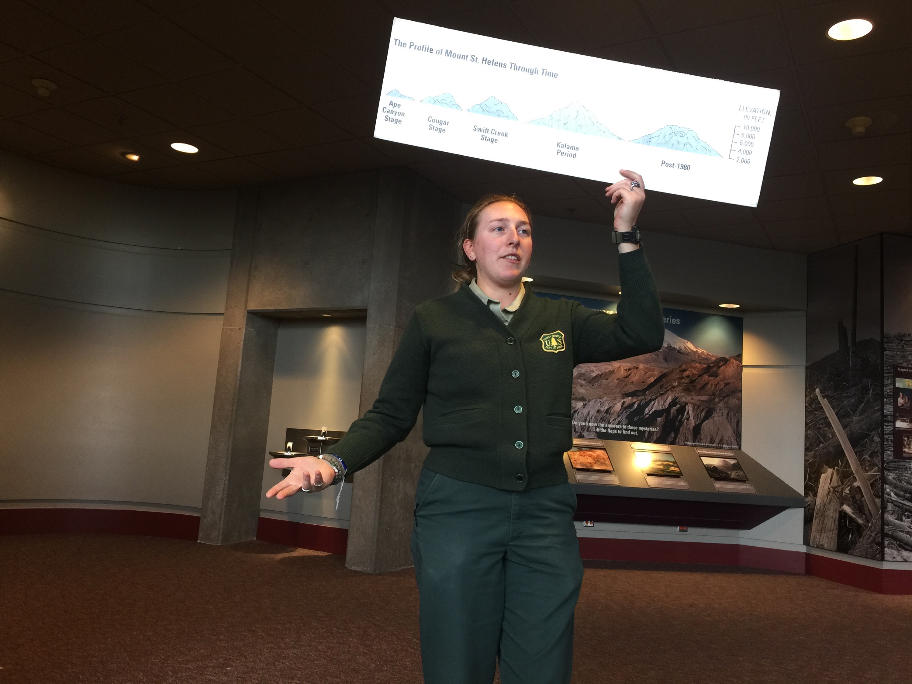
The Observatory had an excellent trail outside which we braved in very high and very cold winds. Inside, in an excellent ranger talk, we learned how and why the lava coming out of MSH is more like mud balls compared to the syrupy flow of those in Hawaii (if I have my notes right it’s because of silica content of the magma).
Mt. St. Helens is actually relatively young for a mountain in this region. And, it is still an active volcano.
The tree below shows the impact of the blast (left side) and the protected side (right). Good bye park. Some mountains facing the eruption were blasted down to bedrock. Nearly 150 square miles of forest were either blown down completely or killed. The pics are incredible – miles and miles of what look like matchsticks blown over in the direction of the 300 mile per hour blast.
We camped that night in Harry Gardner County Park, newly reopened after 35 years. The whole area adjacent to the Toutle River was swamped by mudflow coming out of the eruption. From what we could gather, Cowlitz County citizens led the effort to get this park back to it’s beautiful condition today. Way to go.
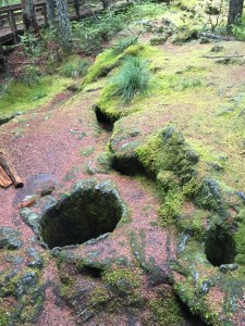
We headed to the south and east sides of the mountain to do some short hikes and see how the eruption did or did not affect various terrains. The south part of the park did not take a direct blow in 1980, but the Trail of Two Forests there shows impact of previous eruptions. While there, an 8th grade class from Camas, WA descended (crazy because we had felt like the only people on the mountain previously) to check out what they’d been learning about in class. Their teacher was awesome! The middle picture below shows the holes left behind when lava encased a tree trunk, then cooled; when the tree rotted or burned away, it left the holes.
Later, we ventured north to the east side of the mountain. Here the views and signage really give you a feel for the incredible effort and payoff of the recovery post-eruption. They are learning so much about how a natural area recovers from such events, trying out different methods of replanting, and of course keeping timber growing and available for lumber companies.
We hiked the Harmony Trail – highly recommended. It leads a mile down to Spirit Lake. Immediately after the eruption, the lake was said to have “disappeared”. If you were a girl or boy scout in this area, you surely would have camped on Spirit Lake. Imagine the devastation as the volcano’s explosion blasted water out of the lake and onto the adjacent mountain sides leveling the forest, then retreated back into the lake, carrying all the tree trunks with it. This area is truly sacred – picture this whole basin filled with mudflow and debris; now the lake is intact, but on its surface floats the remnants of an entire forest felled by the blast. We were lucky enough to be the only ones there when we visited, adding to the experience. At least one life lost here was Harry Truman – an 80-something lodge owner who refused to leave the mountain with his 16 cats, despite pleas from his neighbors and a letter-writing effort by local school kids.
This final picture (from the Observatory) is a neat trick the ranger showed us – my hands show what the summit looked like before the eruption.
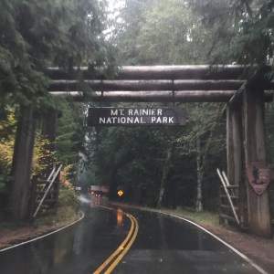
After this incredible trip, we headed just north to Mt. Rainier. And tucking into an excellent camping spot in the adjacent national forest, the rain and cold was just too much for us to do more than (enjoy a) drive through the park – next time! We hear there is sun on the east side of these mountains…
“The town of Oxbow. That’s how you should get to Idaho,” Cropdusting Pilot Chris told us back in Madras, Oregon. “When you are there, you can go to Hells Canyon.” Honestly, if it wasn’t for Chris, we would have missed THE DEEPEST canyon in North America. There is only so much maps, guide books and even Google can tell you. We’ve gotten our best tips from real live people. We headed east with great anticipation.
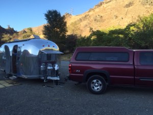
Now, you should know right off what we didn’t: most of Hells Canyon, which surrounds the Snake River, is inaccessible to the casual traveler, and so we really only got a peek at it, but loved it for what it taught us about: Dams and rivers and power, reasons to ever go on a jet boat, boondocking (officially for the first time), and just a taste about the value of fish and fishing in this part of the country.
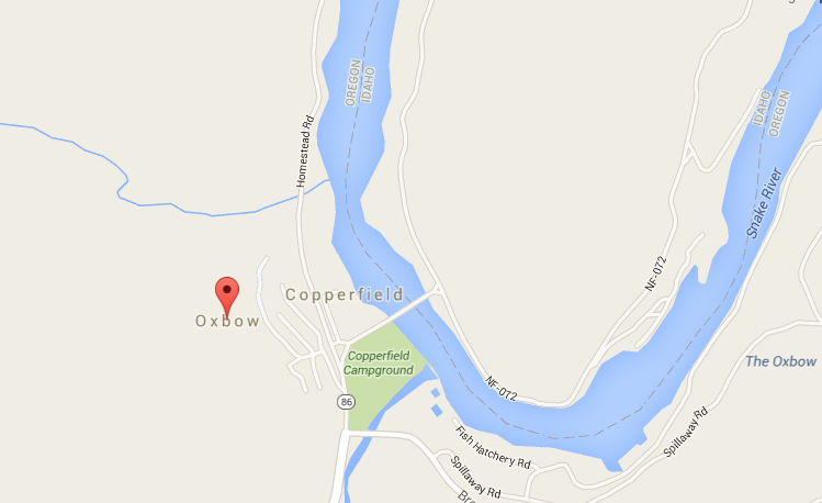
Following the success of getting the best tips from real live people, we asked our young BLM friends at the Oregon Trail site where we should camp in Hells Canyon. They had a bunch of ideas (I took notes), but directed us to a boondocking site just before you cross the bridge at Oxbow.
Oxbow is a very small spot on the map, just on the Oregon side of the Snake River, which divides Oregon (west) from Idaho (east). Boondocking is “wild camping” on unofficial, ungroomed, unmaintained, etc noncampsites. It is FREE and legal – and in
Courtesy of Google Maps
fact encouraged by many public lands, though they usually call it “dispersed camping”. In brochures, on the phone, or best yet face to face at their regional stations, staffers will share with you places for dispersed camping. It’s a bit tough to get the hang of – relying in some cases on only GPS coordinates to find sites, going down a bumpy dirt non-road, not knowing if you can turn around if needed (we have about 40 feet total of vehicles to maneuver.) And, conditions change – there have been so many fires out here – tragic in some cases, just nature running its course in others – that our public servants are doing their best to keep up, and finding us a free place to camp may not be the number one priority, right? But, to circle back, we had the best possible advice and source – from BLM staffers who we’d been chatting with anyway, and were generous enough with their time and insights to help us dip our toes in boondocking.
So – how did we get to our recommended free wild campsite? “Turn left before u cross Oxbow bridge. On reservoir. Tunnel” was all I had in my notes. It actually wasn’t that hard to figure out once we got to Oxbow. If we crossed the bridge, we’d gone too far. Look for a left turn. And a tunnel.The tunnel through a hill of rock was indeed intimidating (to me) but not to Ben. Keep on driving.
Tunnel on way to boondocking site: no problem!
We picked a spot, more of a pullover on a dirt road, indeed overlooking the reservoir, and settled in. When you are a newbie to boondocking you might get a little nervous – Is someone going to tell you to move along? Will your trailer be vandalized? Sure enough, the first other person we saw was a man with a GUN, “just taking his horse out for a ride.” The horse got spooked when he saw his reflection in our trailer. Yep. The second people we saw were two moms with strollers and baby bjorns. OK, we could relax a little.
Our first boondocking site
A view of us in our spot from afar – a little shiny dot!
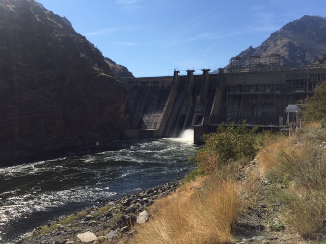
The reservoir we were on was formed from the Snake River and the Hells Canyon Dam – 20 or so miles north and downriver – from our spot. (There are also the Oxbow and Brownlee Dams.) The dams create power of course, and recreation, all governed by Idaho Power. (We barely scratched the surface, but it seems a fascinating intersection of politics, resource management, conservation, and good old boys drinking and fishing. Would love to know more.) It also created a lovely lake-like setting for us to settle in and enjoy the sun as it rose and set across the mountains on both sides (canyon-esque), the birds, the bugs, the jumping fish, and the just-turning fall leaves.
The next day we unhooked – a bit shaky about leaving the trailer in this “unprotected” state but knowing we had a windy road ahead made it easier, and smarter to leave it behind. We crossed the reservoir – we were now in Idaho! A first time in the state for both of us, though this just barely over the border-crossing seemed a bit cheap to count. Passing the dam was incredible – they make it a bit intimidating, like you might have to go through security, though there was none. You realize how valuable dams are, what a target they might be. You don’t have to know much about engineering to be in awe of this.
Hells Canyon Dam
Once we got to the Hells Canyon visitors center, it was a bit of a dead end for us, though just the beginning for those going on jet boat rides and multi-day rafting trips. The road for Chevy Silverados (like ours) literally ends there. There are some nice overlooks, the jet boats, and a nice staffer who told me that most people who explore the Snake do so on multi-day raft trips. The first accessible put out was about 25 miles down river. Amazing.
There is however-and this is a big however- a one mile or so out and back hike along the shoreline which we did and made the trip well worth it. It was so beautiful and like so much on this well timed post-summer season trip-we were the only ones there. We celebrated our two week anniversary as full-timers! A gallery of pics below…I can only imagine what the river and canyon look like beyond this-plan your multi-day rafting trip now!
This slideshow requires JavaScript.
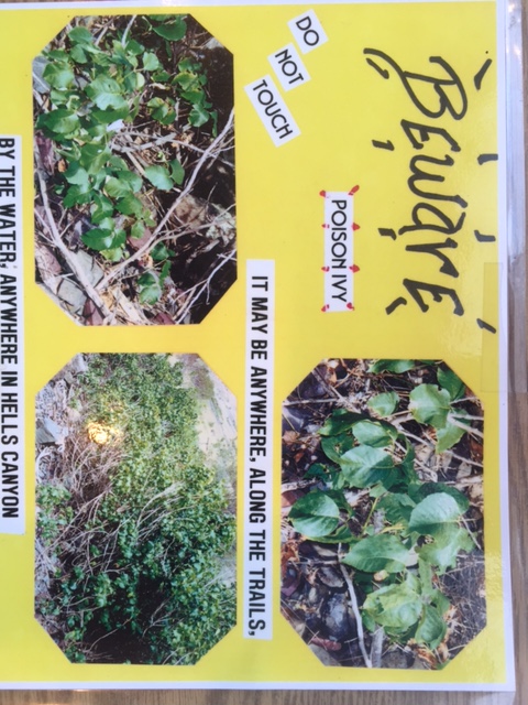
We did have to watch out for poison ivy which I did with my full attention, being super allergic to poison oak. This information saved me, it might save you.
We looked for pictographs and petroglyphs and I thank Hells Canyon for teaching me about what dams do, what reservoirs are, and that there are parts of this country that are “the greatest” but are still very, very wild and not overrun by tourists (like me). I still don’t get what happens to the river – does it just disappear upstream of the dam? Can we make rivers disappear, so it’s easier to go fishing out on our motorboat? Naive city girl, I know.
Back at camp, I went for a swim in the reservoir (a short one). Spent 30 minutes or so watching the show nature was putting on as the sun was setting – a cliche I know, but so accurate. A great show.
Me being still and quiet. Not a joke.
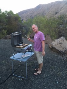
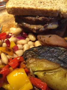
We grilled hamburgers for dinner and made a grilled veggie white bean salad to go with. We thank the Kaufmann’s in Island City, Oregon for the local bread, beef and veggies. Still working on my food photography.
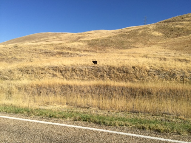
The next day we headed to Boise, the big city, a couple hours southeast. We had one last surprise as we transitioned from the wild to civilization: the little baby bear (below) on the side of the road – perfectly content until he saw us. Luckily we saw him and slowed down and we got to watch him bound away. Blacker than we expected, wide eyed, and very bouncy. Godspeed.
He was only about 20 yards from us when we spotted him. Then bounded away.
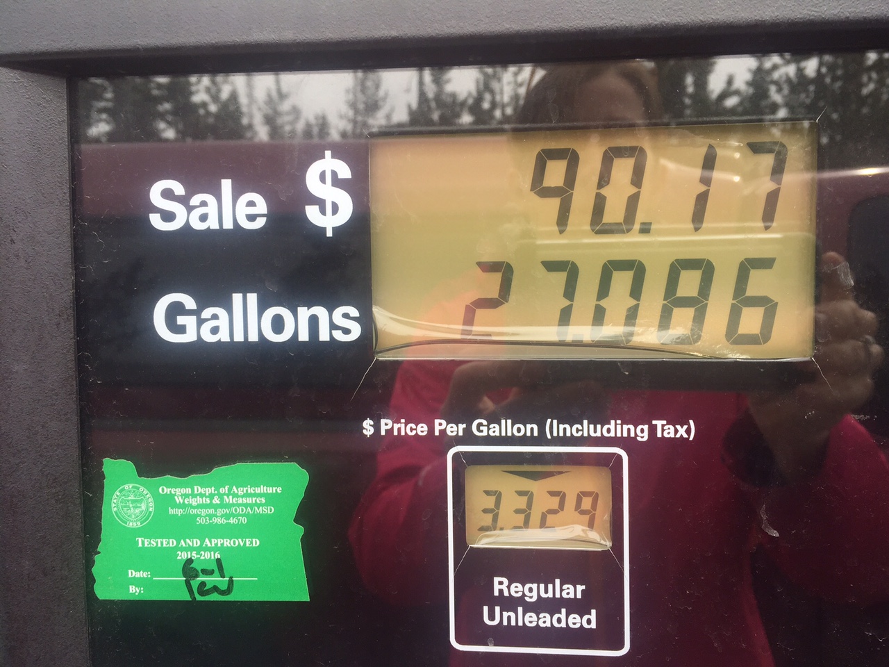
We turned off the road to head to Crater Lake – the only National Park in Oregon and a site we might have skipped if not for friends’ recommendations – with less than a 1/4 tank of gas and no reservation. We hoped to stay IN the park-its campground is the closest to the lake, making access easy. But I was nervous-what if the campground was full? Our M.O. of making plans one day ahead of time does not square with the park’s online reservation system that you plan at least (a shocking) two days ahead of time. Plus-gas! We’ve been averaging 11.5 miles a gallon. Ugh.
We’ve been logging our mileage/fuel costs – biggest expense so far especially as we’ve been making tracks.
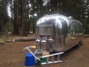
We zoomed past the entrance with our national park Golden Eagle pass (a bon voyage gift from Ben and Joan – merci!) straight to the kiosk for walk ins. Score! Campsites available plus… gas pumps, located on site! We did our circle the campground loops thing, picking out the best site and chose D loop, site 13, overlooking a lovely gorge. Temps were cold – snow / rain was in the forecast.
This is our fourth campground, and though our carefully posed photos of the others might suggest otherwise, this is the first one that really made us go WOW.
Maybe it’s the time of year – not too crowded, summer fading – but the forest is lovely, the chipmunks camera ready, and the sites were (all?) pull through rather than back in which we hadn’t seen yet. And I guess really – and this is maybe connected to it being a national park – no road noise, far from “civilization”.
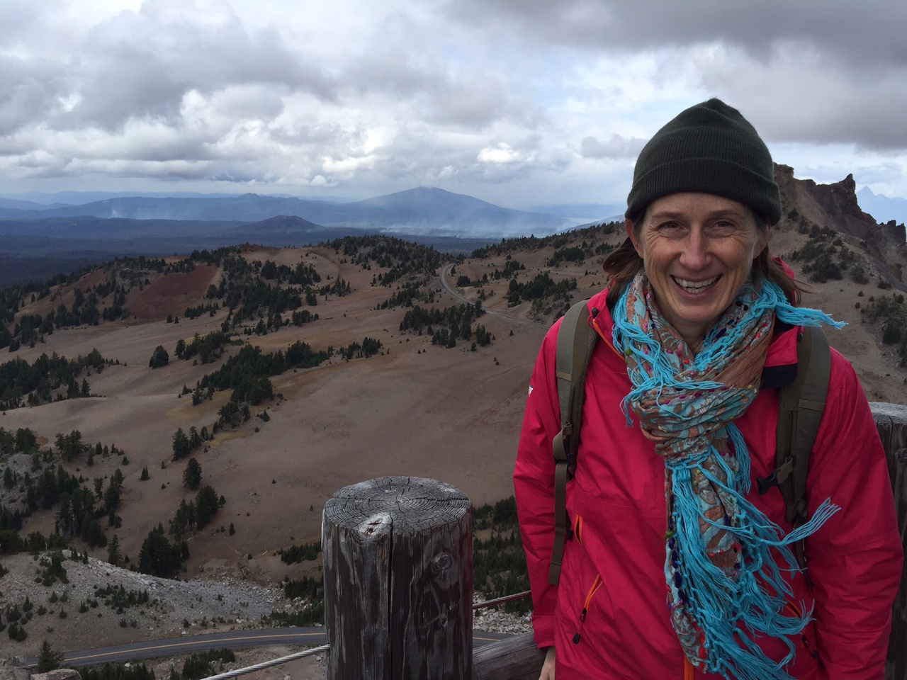
Switching out and into our cold weather wardrobe.
Doesn’t show how cold it GOT, but a stark contrast from California
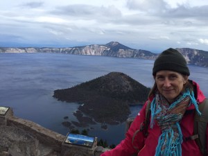
Your first view of the lake is breathtaking – clear, blue, vast.
We did a ranger talk, a hike, and the rim drive – about 22 miles.
I heard that the best things to note in a travel journal, or in photos, are the things you want to remember.
Things we want to remember about Crater Lake:
Ben: The park ranger, in his talk had us picture the people living in this area when the volcano blew – imagine your whole life a 12,000 foot mountain is a part of your landscape. Then one day – in less than 12 hours – it was gone, replaced with a 2000 foot crater (or more accurately a caldera.)
Ranger talk. Always entertaining.
The volcano within the caldera.
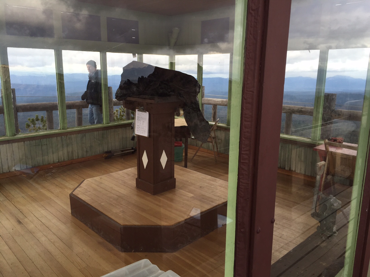
Meg: The hike up Watchman – where there is a national landmark fire watching station – still used today. With key supplies like a pencil, pencil sharpener and glass cleaner.
Firewatching station up watchman hill.
There were actually fires in the distance too – set by lightening, watched and controlled by firefighters. Naturally occurring fire (lightning), that doesn’t threaten human property or people, is an important part of the natural process and is allowed to burn.
At the top of the Watchman – where firefighters still look out and have been since the 30s.
We had such a great day – and a night of freezing temps as we were still missing a few parts to get the propane heater warmed up. Our gas stove warmed things up a bit and wool blankets too. Ben’s fingers nearly froze hooking up the trailer to leave in the morning.
Snow on our way out of Crater Lake the next day. ZERO visibility.
Doesn’t hurt to celebrate an anniversary – and I’m currently typing/posting this while doing another FIRST: Laundry! Woot!
One last pic of the lake – they call it the phantom ship. Lovely. Like a little Airstream!
 Sometimes (all the time), you should just do exactly what the ranger tells you when you ask them for a two day itinerary for first-timers.


 Arizona, and Cactus League Spring Training. We saw the excellent movie Spotlight, and had Korean food at


 breakfasting outdoors – something we haven’t done in a while. Our breakfasts can get pretty routine, but I love them all: it’s either cereal, oatmeal or eggs. This must have been a cereal or oatmeal day. The only downside is Ben and I have to eat the same thing – due to just wanting to avoid two people in the kitchen, extra dishes, etc. Oh, what we give up to go on a once in a lifetime cross country trip!
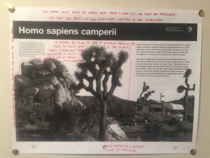
 After consulting with a ranger, we set a course to do several short hikes as we crossed the park from the West Entrance, past our campground, toward the south entrance. If fact, you may want to start calling us “Short Hike Barkers on Break,” we did so many. Feel free to follow along (from left to right) on the


 rock that has campfire smoke from who knows how many eons of campfires.
 d us of one of our cats, Gordo (who’s orange too).


 sentence in Alcatraz – I won’t spoil it by saying what it was for (think Wild West). The oldest Keys son visited the site regularly until he died just this year. He will be interred at the family plot still on site. The tour cost 10 dollars, and is only offered three days a week, though they are popular enough that they will be adding some more. I imagine it’s a struggle for the hardworking public servants at NPS to have to limit access to such a cool part of the park.


 into the park for the afternoon with just the truck. And, assuming all continued to improve, we’d surely be able to get in with the trailer the next day (Thursday). As with the 99% of other times when Plan A has failed, Plan B turns out to be as good or better. Because look who we got to meet at the Indian Cove RV Park? Tigger, the RV park cat.
 We stopped in the Visitors Center to do a quick perusal – watched one of the movies and came out to a completely altered night sky. Is this what it’s like every night? Wow.

 But wait, here is where the 2nd piece of advice we received kicks in: from my friend Joan’s book shelf, she kindly let me borrow “


 us and got off at the Yosemite Lodge (for hot chocolate) and walked to the Yosemite Falls foot bridge. It was nearly deserted, and though the iPhone pics don’t do it justice, a lovely way to see the falls.
 The trail to the Falls was quite icy in spots. We hiked alongside a group of 8th graders and figured if they could do it, so could we! The elevation gains were gradual enough so it wasn’t just a slog, and the views changed incrementally providing something new to look at at every switch back. Again, pictures don’t do it justice. Once we got to the falls, we were up for going a bit further so continued on toward Nevada Falls.
  We got just to Clark Point and the road closed signs were enough for us to call it quits there. Many other hikers, mostly fellows on their own, hopped the fence and kept going (they had better equipment) but so did a group of three women in their 50s from Korea – one of whom lives near Yosemite now and comes every few weeks to hike.


 Ashland Co-op and scout out restaurants for before a concert we were heading to that night. As we winded down this first leg of our trip, it seemed we still had some work to do to check out the night life / cultural events in the places we visited. This (left) folks/bluegrass/orchestral mix of groups was right up our alley. They even had a hammer dulcimer! One of the leads, Emy Phelps, is from Ashland, so it was a homecoming event for her. A highlight was when they brought all the local (about 20 kids) young violin students up on stage with them to join in for one of Emy’s songs. The parents especially loved that because all those hardworking novices sounded so good in harmony with the professionals. The whole vibe was about collaboration and education, a mix of young and older, lots of smiles and great music! Culture and nightlife – check!

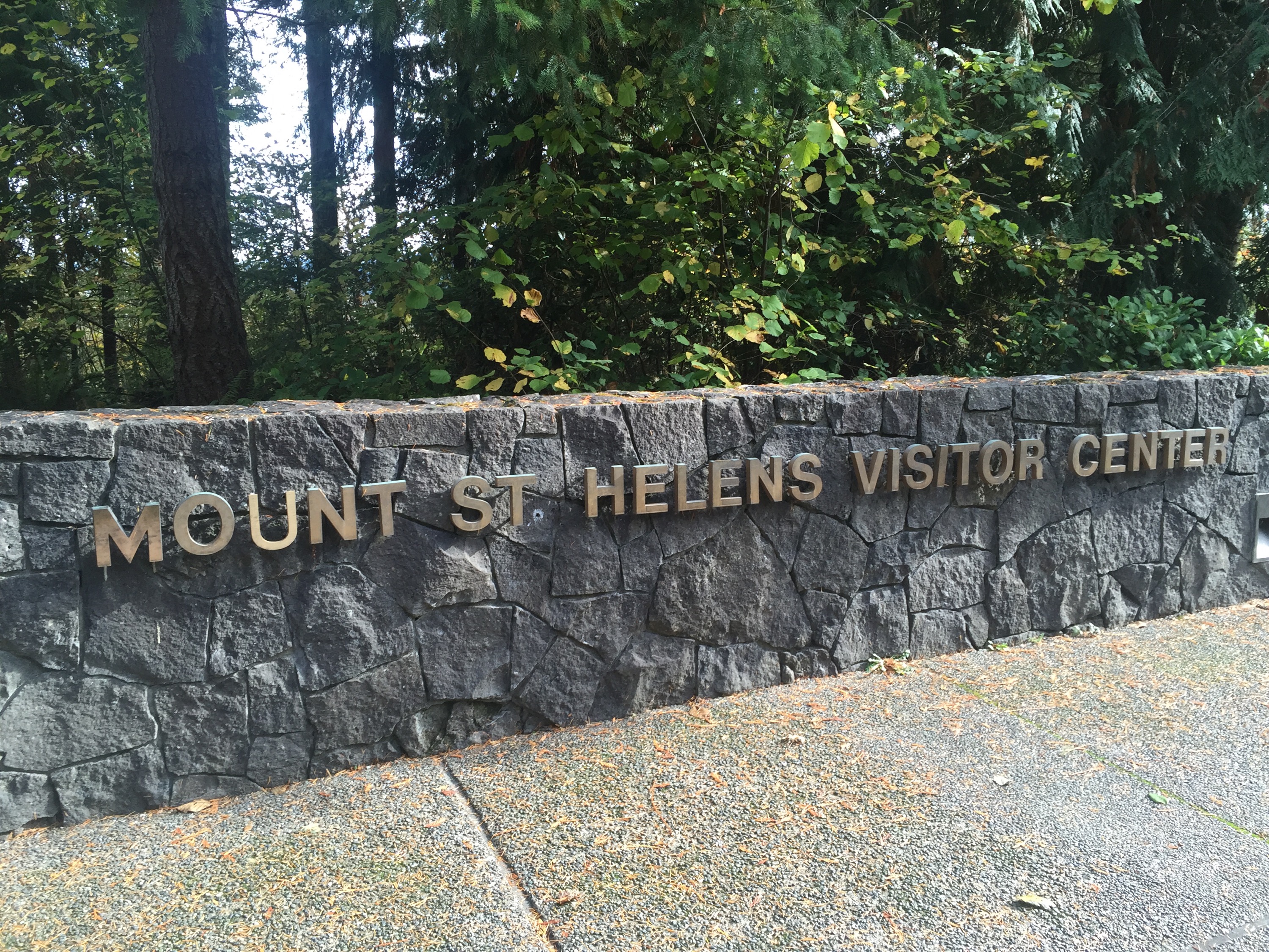
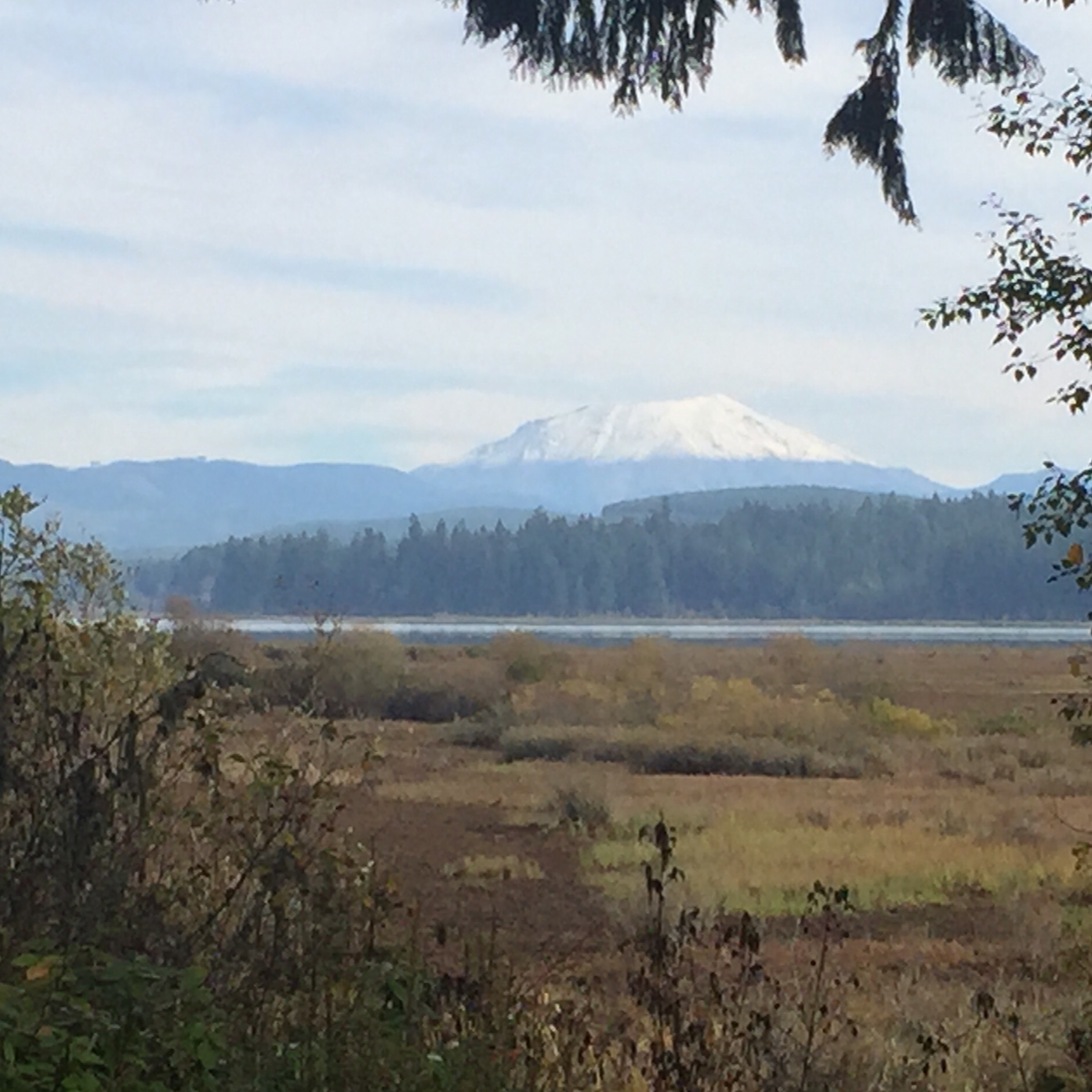

 on the readings off the mountains they were getting in the weeks and days before May 18th, 1980. Though the area around there isn’t widely populated, it is/was a popular summer destination, with cabins, lakes, camping, etc. Police had set up checkpoints all around keeping people out on the advice of people like Johnston. You can imagine, especially with the run up to summer, the pressure from residents, business owners and others. This exhibit panel to the right from the Silver Lake Visitors Center tells some of that tale.