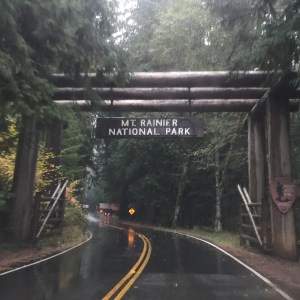
We spent a lovely long weekend in Seattle with friends new and old, enjoying our first days in a REAL bed since our trip began almost two months ago. We headed to Mount St. Helens – that perfect mix of history, nature, and places we might never get to in a world of limited vacation time. Though we’d heard enough from Seattle-ites about the wonderful precious mountain views that only come “on your tiptoes during full moons when the breeze is blowing just so, and a black cat hasn’t crossed your path, etc”, we were pretty blown away by this view of Mt. Rainier on our way out of town, south on 5. A foreshadowing of spectacular sights to come…

Mt. Rainier, on a unusually clear day, heading south from Seattle on THE 5!
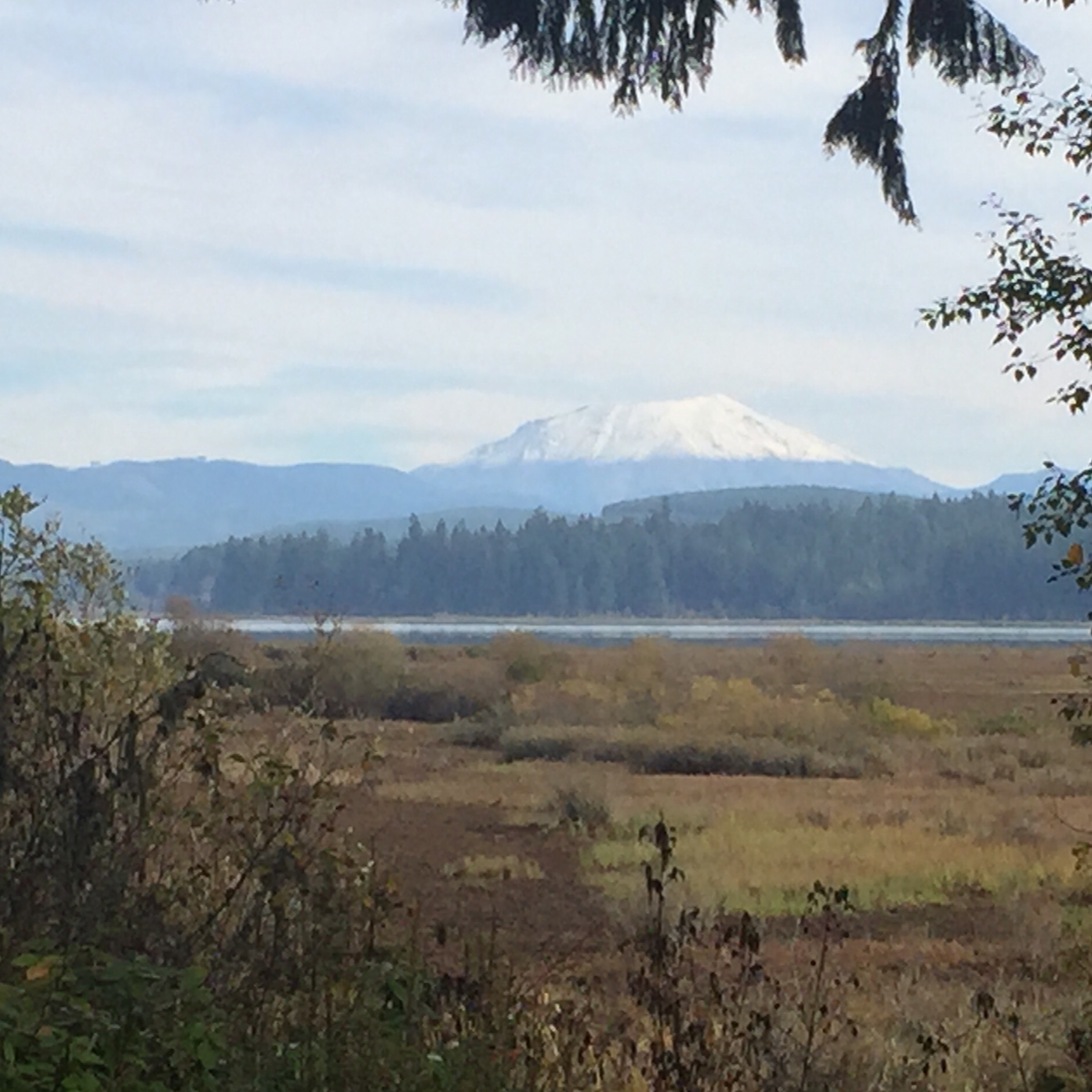
Soon we were in the land of volcanoes, many active in the Cascades reg ion (being so close to those Pacific faults you know), and one famously so 35 years ago, Mount St. Helens. Though we both remember the eruption, we don’t remember that there had been plenty of warning (seismic, geysers, a bulge on the northwest side that grew five feet(!) a day) that a major volcanic event was coming, and that somehow made the human story behind what happened here even more compelling today. The weather held and we were greeted with this view when we arrived at the Visitor Center at Silver Lake. It’s in an area northwest of the mountain which was devastated by the eruption. The exhibits there focus on the impact on the local community.
 The staff there suggested (thankfully!) that we hightail it to the Johnston Ridge Observatory — about 50 miles west — for a closer look at the mountain and to take advantage of the spectacular visibility, which weather reports suggested would not be coming again any time soon. Plus. the observatory is only open seasonally and closing in a few days. We made plans to return to this VC the next day and headed up the mountain.

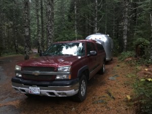
About halfway up to Johnston Observatory – elevation not too bad for towing the Airstream but these viewpoints are convenient to give the truck a rest. I believe the snowy peak to the left is Mt. Baker..
Johnston Observatory , 5 miles from the summit, is named for David Johnston, a 30 year old (!) volcanologist working with the U.S. Geological Survey (USGS) who died in the eruption. He is credited with saving hundreds/thousands of lives because of his warnings about the danger based  on the readings off the mountains they were getting in the weeks and days before May 18th, 1980. Though the area around there isn’t widely populated, it is/was a popular summer destination, with cabins, lakes, camping, etc. Police had set up checkpoints all around keeping people out on the advice of people like Johnston. You can imagine, especially with the run up to summer, the pressure from residents, business owners and others. This exhibit panel to the right from the Silver Lake Visitors Center tells some of that tale.
The eruption itself happened on a Sunday morning, at 0832. The day before, police had escorted anxious property owners in and out for quick checks and to retrieve belongings – folks had been barred from visiting their homes since March, when the first eruptions occurred!. Officials were planning to allow homeowners to briefly return again on Sunday. That morning, David Johnston was at his observation post, located about where the Observatory is today. His final recorded words came as he urgently radioed USGS headquarters in nearby Vancouver, WA …“Vancouver, Vancouver, this is it!” The eruption began as a lateral eruption – just like it sounds – the mountain blew up sideways. Because it is so unusual, it was unexpected, even to the scientists. These pictures were taken by a camper who just happened to have the perfect vantage point – and hightailed it away with his life. We camped here the second night.

From Bear Meadow pull-out off 99 on the east side of the park. Pictures taken by Gary Rosenquist, a private citizen who chose this camping spot that weekend, hoping but not nearly being able to predict that he’d get pictures like these.
Then, later, the 12 mile high eruption. This postcard below is going to my nephew, but for now, please enjoy. Unbelievable.

David Johnston’s body has never been found. 56 other people died.
The Observatory had an excellent trail outside which we braved in very high and very cold winds. Inside, in an excellent ranger talk, we learned how and why the lava coming out of MSH is more like mud balls compared to the syrupy flow of those in Hawaii (if I have my notes right it’s because of silica content of the magma).
Mt. St. Helens is actually relatively young for a mountain in this region. And, it is still an active volcano.
The tree below shows the impact of the blast (left side) and the protected side (right). Good bye park. Some mountains facing the eruption were blasted down to bedrock. Nearly 150 square miles of forest were either blown down completely or killed. The pics are incredible – miles and miles of what look like matchsticks blown over in the direction of the 300 mile per hour blast.
We camped that night in Harry Gardner County Park, newly reopened after 35 years. The whole area adjacent to the Toutle River was swamped by mudflow coming out of the eruption. From what we could gather, Cowlitz County citizens led the effort to get this park back to it’s beautiful condition today. Way to go.
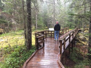
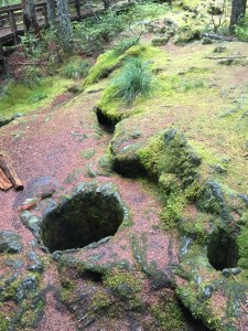
We headed to the south and east sides of the mountain to do some short hikes and see how the eruption did or did not affect various terrains. The south part of the park did not take a direct blow in 1980, but the Trail of Two Forests there shows impact of previous eruptions. While there, an 8th grade class from Camas, WA descended (crazy because we had felt like the only people on the mountain previously) to check out what they’d been learning about in class. Their teacher was awesome! The middle picture below shows the holes left behind when lava encased a tree trunk, then cooled; when the tree rotted or burned away, it left the holes.

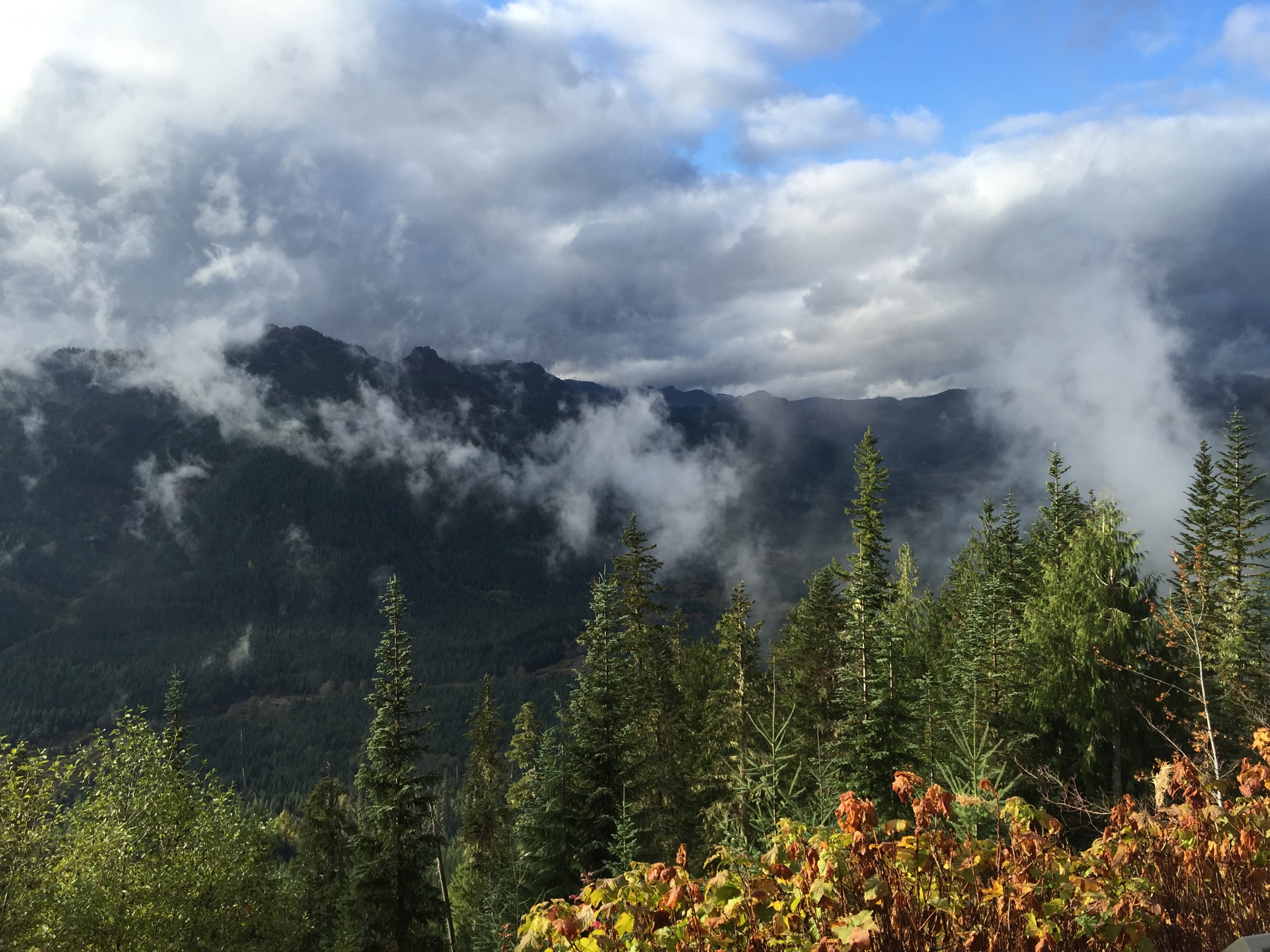
Later, we ventured north to the east side of the mountain. Here the views and signage really give you a feel for the incredible effort and payoff of the recovery post-eruption. They are learning so much about how a natural area recovers from such events, trying out different methods of replanting, and of course keeping timber growing and available for lumber companies.
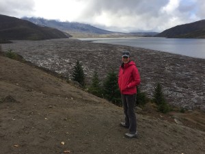
We hiked the Harmony Trail – highly recommended. It leads a mile down to Spirit Lake. Immediately after the eruption, the lake was said to have “disappeared”. If you were a girl or boy scout in this area, you surely would have camped on Spirit Lake. Imagine the devastation as the volcano’s explosion blasted water out of the lake and onto the adjacent mountain sides leveling the forest, then retreated back into the lake, carrying all the tree trunks with it. This area is truly sacred – picture this whole basin filled with mudflow and debris; now the lake is intact, but on its surface floats the remnants of an entire forest felled by the blast. We were lucky enough to be the only ones there when we visited, adding to the experience. At least one life lost here was Harry Truman – an 80-something lodge owner who refused to leave the mountain with his 16 cats, despite pleas from his neighbors and a letter-writing effort by local school kids.


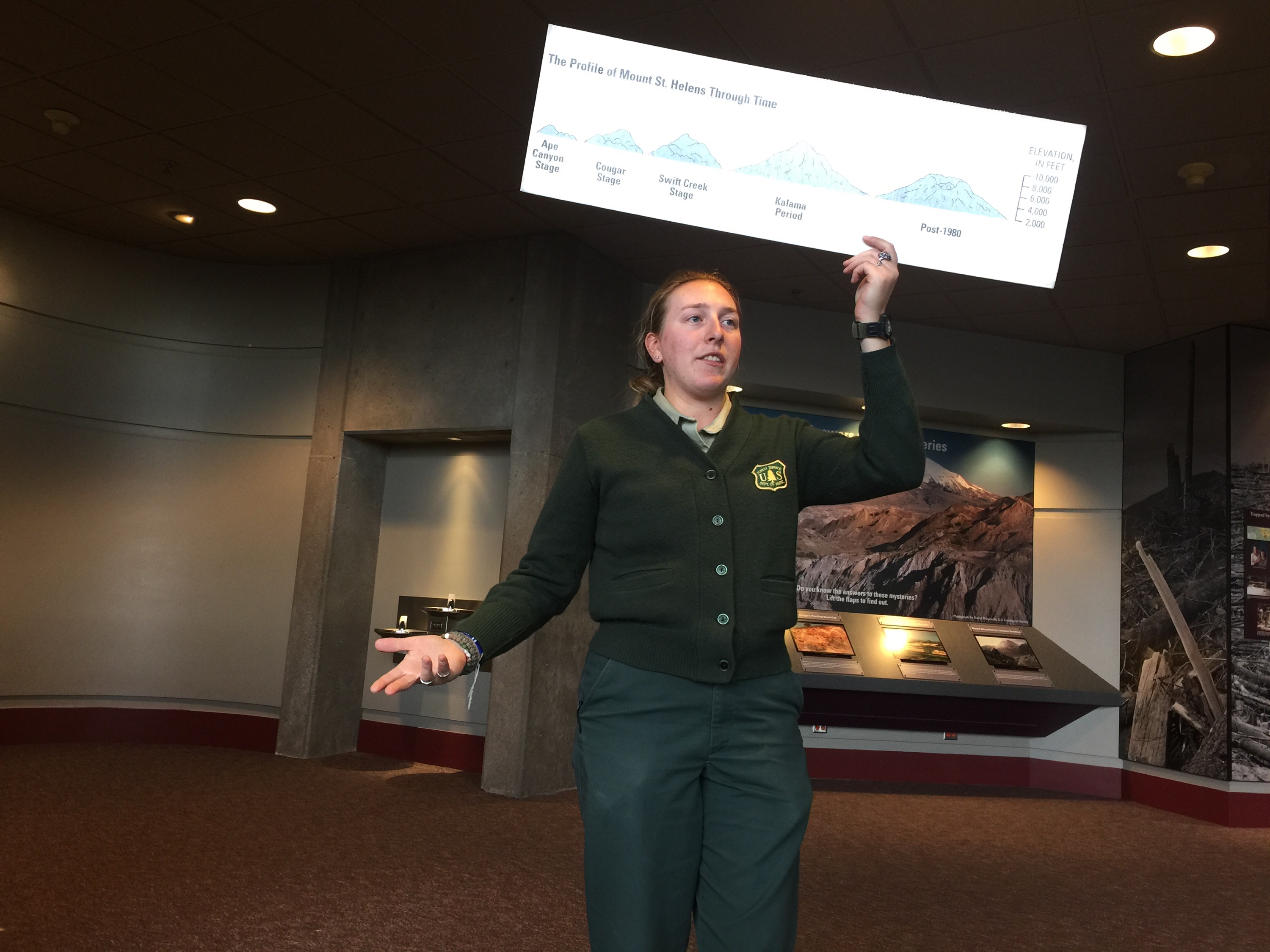
This final picture (from the Observatory) is a neat trick the ranger showed us – my hands show what the summit looked like before the eruption. 
After this incredible trip, we headed just north to Mt. Rainier. And tucking into an excellent camping spot in the adjacent national forest, the rain and cold was just too much for us to do more than (enjoy a) drive through the park – next time! We hear there is sun on the east side of these mountains…