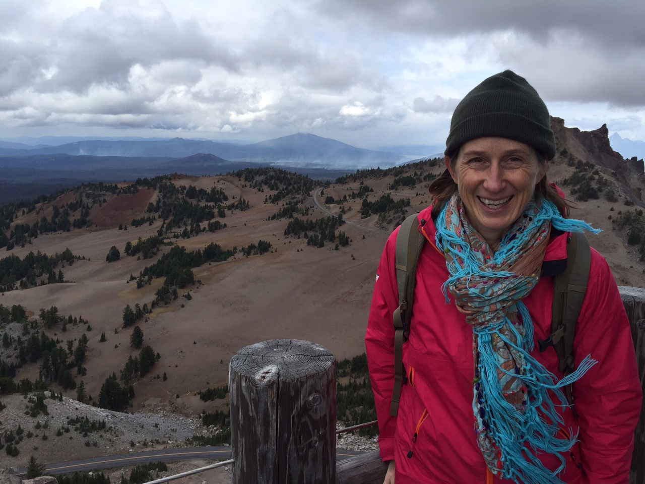
We are spending a few months in Newport, Oregon, volunteering at the Yaquina Head Outstanding Natural Area, a BLM site that includes gorgeous coastal cliffs, beaches, birds, marine mammals, tidepools and yes a lighthouse. Whilst I was rangering last summer in the Vermont mountains, Ben was was combing through volunteer.gov to find us a gig on the water, so here we are! Our last hurrah before we are back to real life.
In exchange for volunteering four hours a day, five days a week, we have a free spot for the trailer, including water/electric/sewer. From our concrete pad (below left), we can see the ocean, if we lean a bit; a pair of bald eagles every time we walk out our door, if we are lucky; and this super cool stained glass peace sign our friend Laura made us (that somehow Ben has let me keep up-must be love of Laura who is also our #1 cat wrangler), if the incessant rain doesn’t wash it away.
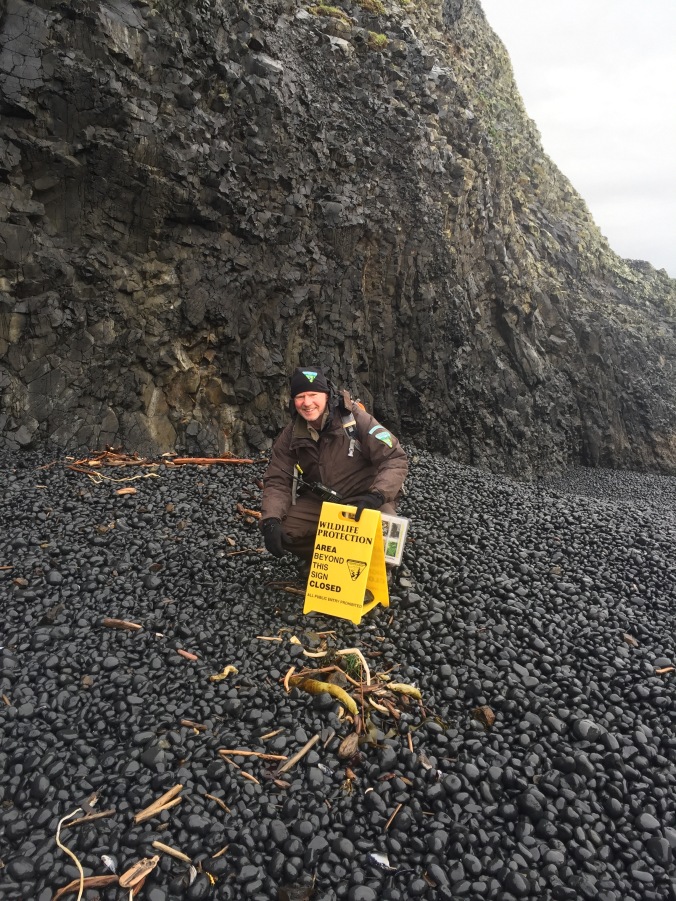
In order to accommodate our new lifestyle, we had to invest in a dehumidifier, that requires emptying no less than 3X a day (in our less than 200 sq ft living space). We also got a white board calendar to mark our work start times-it changes every day depending on the tide. If it’s low tide, to Cobble Beach (below) we go to protect the sea stars, urchins, anemones & co. from the enemy: tourists. JK – tourists are rad, but this is a designated marine garden and we just need to keep an eye out and help everyone stay safe. BLM thoughtfully provides rain gear which we work, play and sleep in.
At the beginning and end of each tidepool shift, we put out these signs so folks will stay back from places the harbor seals like to hang out.
I almost stepped on the octopus below – see how well she blends in with the kelp! One can never get enough sea stars in the frame (below right). Their population was quite diminished by a mysterious wasting disease in the last couple of years, but shows signs of coming back. You’ll see some purple urchins and green anemones tucked in as well.
When we are not in the tidepools, we staff the Interpretive Center desk. A highlight is raising and lowering the flag (in rain gear naturally), and updating the white board with tide and weather information (you guessed it: rain). Have I mentioned the snow?
Or we might go a-roving – hiking the short trails, or bringing out telescopes so visitors can see the peregrine falcons, or until recently, the migrating whales.
In January, we caught the tail end of whale migration south. The stragglers.
The female peregrine falcon, captured in the screen of a birder’s high powered camera
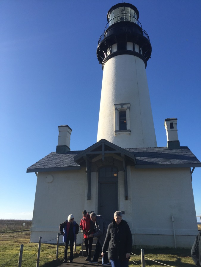
We sign people up for lighthouse tours – and took one ourselves on one of the few sunny days. The lighthouse has been in operation since 1873. It’s a first order Fresnel lens. Automated in the 40s.
A few more tidepool sights below. We are there often enough that it’s pretty easy to notice something new or different. The rangers helps us out with id-ing stuff.
A cluster of fish eggs, sort of like a popcorn ball. A special treat for hungry gulls.
Gumboot chiton – this one is deceased. The dark red color on the edges is almost totally receded.
I’ll leave you with an octopus video of the same little lady pictured above. She scooted around for several minutes close to my boots – I was more afraid of her than she of me. She was likely trying to find her way back into the water. Rangers said it is pretty unusual to see one, and very unusual to see one out of the water. So here you go…up, doh, I have to upgrade to post video on WordPress. Go see it on Instagram where I can hopefully post it. 🙂 More from Oregon soon, specifically: on how one passes one’s free time in a 200 square foot trailer when it’s raining (constantly).
We have gone up, down, around, and through Oregon on this trip. 10 days on our swing north in September (read about some of that here, here, and here, another 10 days on our swing back south in November. Though, embarrassingly, I included the first night of this second leg in Oregon in a post about Washington state. Sorry The Dalles!
Having visited Portland, Willamette Valley, and some of the coast about 10 years ago, we were pumped to revisit some of our favorites and find some new places to explore as well.
We’d been to Astoria before – a neat, real (not just a tourist) town on the coast, at the mouth of the Columbia River. Astoria welcomed us back with a beautiful rainbow!
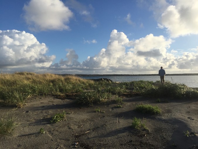
We stayed in Ft. Stevens State Park – and got lost looking for the campground, but as usually happens once you get past your annoyance at the GPS, our wrong turn led us to some beautiful sites and we took a walk around the jetty.
The main thing we wanted to do this go round in Astoria was visit the Ft. Clatsop National Historic Park, where Lewis & Clark wintered over after completing their westward journey. The Corps of Discovery did not enjoy their time there — it rained a bunch — but we did especially because the park had been closed due to a fire when we here 10 years ago. We don’t have any pictures (!) but we do have this video we made there because our visit coincided with our nephew Carter’s birthday. It also just goes to show if you didn’t get that card in the mail on time, with a little creativity and the wonders of technology, you can do something cool to make up for it.
We rode our bikes to Ft. Clatsop – it was a little further than I thought it would be, on some busy roads too, but I would still recommend it. I don’t know if this is novel to anyone, but when I am low on batteries or data or coverage, I take a screen grab of my route and refer to that as I am able.
The museum and site were very good. The replica fort (seen behind us in the video) was smaller than I thought it would be – you get a real sense of the Corps just hoping to – I dunno – maybe stay warmer by being so close together? Having less of an area to defend in case of an attack? I appreciated the attention to the long term fate of each Discovery Member in the exhibits, especially York. In the evening we treated ourselves to dinner at the the Bridgewater Bistro in Astoria. The food was only pretty good, but because the service and the setting were so spectacular, we’d recommend it. They let us combine two desserts into one – a chocolate brownie with coconut ice cream. And the crab cheesecake appetizer was excellent.
On the way out of town, I stopped in the small but lovely Astoria Co-op, while Ben waited in a very long line to get his haircut at the Eleventh Street Barber. He passed the time by chatting it up with some local Coast Guard fellows, and I was amused by the proprietor who kept offering everyone cold beer from the mini fridge.
After a quick trip back to Seattle for some “admin” and a chance to visit dear friends in Auburn, we spent one more night in Washington – at an Airstream park, the aptly named Washington Land Yacht Harbor. The Park was pretty basic and they’ve opened it up to non Airstreamers (but if you are WBCCI members, there is a discount). There is also a fairly large brick and mortar home community surrounding the park – only requirement is that you must own an Airstream to buy a home there. We chatted a bit with one of the residents about the history of the park — folks with a common interest coming together to build a community — and the ways they are working to keep it going today. We made a quick stop at the Olympia Farmers Market (get the cinnamon bread from Wagner’s and any jam from Johnson’s Berry Farm) and the state capitol (pics below) before we recrossed the border.
Any resemblance?
Capitol interior
On to Portland! My friend Tom and his wife Julia about 10 years ago got to pick anywhere in the US to live after many years in NYC – and they picked Portland. How hip they are! Tom may not have known what he was in for when he said “You can park in front of our house!” on one of my Facebook posts tracking our travels, but regardless, we were “all in” as guests (though they were lucky we had just done our laundry in Seattle!)
Tom indeed had a lovely place for us to park in front of his house
After an afternoon of chatting and catching up we had a great dinner out – we wanted to go somewhere “Portland” and we knew Julia picked a good restaurant when the waiter assured us their pork come from pigs that are “pumpkin fed”. I couldn’t remember the name of the restaurant but just found it by googling all the things from their eclectic menu that I especially liked: “short rib sushi bread pudding” – and it was the first hit! Pono Farm Soul Kitchen in Northeast Portland. Yum.
We had a fortuitous meeting in Tom’s kitchen the next morning over coffee and cinnamon bread – his friend Stuart came by and once we realized he was a guru on Oregon travel, we asked and he gave us all kinds of tips on where to go, in what order, via what road, down to which Dairy Queen was the best in the state and how to work in a side trip to the town where some of Animal House was filmed. Not only that – he told us his mother grew up on a farm near Eugene, his sister lived there now, and would we like to park the Airstream there? Yes!
Following Stuart’s tips, we headed south to Willamette Valley, via Oregon City, the final stop on the Oregon Trail. The VC there is a bit pricey, and at this point we maybe felt a bit overloaded from other related sites we had visited but it provided nice closure to that theme of our travels and a good photo op or two.
Exterior of the museum depicts – a wagon!
The museum had kid friendly exhibits which Ben enjoyed too
The plaque: “End of Oregon Trail”
We headed south into Willamette Valley, to our Harvest Hosts Kramer Vineyards near Gaston. Though they were having an event that night – they couldn’t have been nicer and more accommodating to make room for us. We arrived just in time to jump in for the heritage vertical pinot noir tasting – basically tasting the same vintage, but from six different harvest years. Their thoughtful placemats (below) explained some of the differences in the rainfall, temperature, harvest date, yield, etc of each year. The owners encouraged us to sip, take notes, let the wine breath some more, repeat. It was awesome – I appreciate good teaching and this was it! We were seated with this really nice couple who are wine club members there and were so generous as to cover our tasting bill as part of their guest allowance. I know this is not exactly like the kind of generosity Cheryl Strayed writes about receiving on the PCT when her 20 dollars didn’t arrive and she wanted a Snapple, but we were very appreciative nonetheless! We even bought some Pinot Gris to go – in a growler! – so though the wine is gone, we have a very nice souvenir of this visit.
Next we headed west to the coast, and an overnight at Nehalem Bay State Park, complete with another rainbow and the best walk on the beach yet. We made some excellent lentil soup here which we ate while watching “Waiting for Guffman”. (Not wanting to use our data to stream, we pick up old DVDs wherever we can!)
On the way south, we stopped to do the Cape Trail at Cape Lookout State Park. This trail is truly fantastic – gets you out, as the name suggests, on a cape, with gorgeous views of the Oregon Coast. The hike was fairly flat but with some difficult passages due to mud, rain, general dampness that was the weather for much of this leg of the trip. But fantastic hike – highly recommended for coast lovers. Before the trip, I had surgery to repair an ankle ligament tear and I take pictures like that in the lower right to send to my surgeon some day as a thank you.
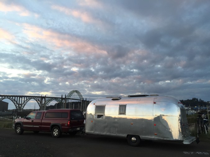
On to Newport, where an excellent Wheelingit blog post about free or cheap(er) camping on the Oregon Coast led us to the Port of Newport Marina. We always enjoy a marina, though the dry site parking area was adjacent to the Rogue Brewery warehouse and a few semis kept their engines running while resting there at all hours. But the view (below) couldn’t be beat.
Yaquina Bay Bridge just south of Newport, OR, in our dry camping spot at Port of Newport Marina.
We walked a hundred yards to have dinner at the Rogue Brewery Pub that night – the food was excellent! Try the crab kimchi sliders appetizer for sure. The next morning we walked a few hundred yards and forked over the big bucks to explore the Oregon Coast Aquarium – click on the link to see the best URL ever. We don’t begrudge museums entry fees, but it always feels a bit of a risk. In this case, it was well worth it. The Aquarium has more than a little bit of everything including live animal feeding demos, a walk through a shark aquarium tunnel, and thoughtful exhibits with volunteers and staff who were very good at their jobs answering questions, sharing what they knew and passing on a respect for the natural world.
This volunteer with the puffins was so knowledgeable and knew just how to engage her audiences.
The pelican exhibit stage had recently been enlarged so the staff are painstakingly familiarizing the animals with the new space.
Otter feeding – all maies – they compete to be the alpha (I heard from the puffin volunteer.)
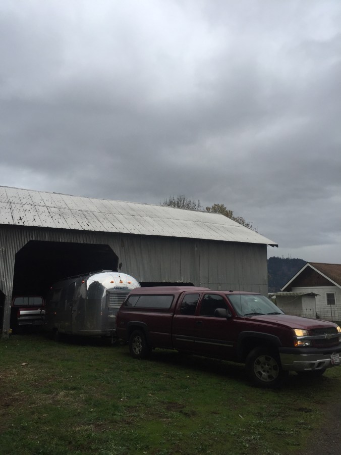
We headed east to Stuart’s sister’s house – the Hurd family farm. The barn – 100 years old–was an awesome setting and we enjoyed our neighbors, sheep, chickens and rooster.
The next day, I headed into Eugene. It’s always fun to check out a big college campus and University of Oregon was lovely. I checked out Hayward Field – home to track and field legends – and their art museum, which had a cool exhibit on post war Japanese prints. As I walked across the same type of criss-cross quads I traversed as an undergrad, I caught snippets of conversations among the students – worries about how to bring up a grade (this from someone on a cell phone), wishes to check out new restaurants (or food trucks), a mission to return some rain boots. Though so much has changed, so much is the same.
We finished off the state with a visit to Ashland, home of the Shakespeare Festival for most of the year, but not this month. I did a quick hit of their downtown to do a little shopping of my own, of course visit their very large and very good Ashland Co-op and scout out restaurants for before a concert we were heading to that night. As we winded down this first leg of our trip, it seemed we still had some work to do to check out the night life / cultural events in the places we visited. This (left) folks/bluegrass/orchestral mix of groups was right up our alley. They even had a hammer dulcimer! One of the leads, Emy Phelps, is from Ashland, so it was a homecoming event for her. A highlight was when they brought all the local (about 20 kids) young violin students up on stage with them to join in for one of Emy’s songs. The parents especially loved that because all those hardworking novices sounded so good in harmony with the professionals. The whole vibe was about collaboration and education, a mix of young and older, lots of smiles and great music! Culture and nightlife – check!
I’ll end with a scary story (with a happy ending) and a cautionary tale. On our drive to Astoria on I-84, we encountered what was without a doubt the scariest moment driving and the closest we’ve come to an (what would have been awful) accident. We are cruising along in the slow lane, and the first we saw anything, the semi in front of us came to a screeching halt and Ben reacted, braking hard, slowing us down, with one hand protectively on me (I think he was trying to keep me from screaming as much as from slamming into the dash) as he very very calmly and slowly said, “OK, I am not sure we are going to stop in time.” Yikes. Hold on, hold your breath and watch the road between you and the 18 wheeler in front of you slowly disappear.
We did stop in time though, with a few feet to spare, but then of course the worst was still to come as we waited with stiffened backs to see if any cars behind us would slam into us (and the Airstream!)
This was NOT the truck/appliance that nearly caused us to crash
As Ben looked left, trying urgently – without success for a long minute or two- to look for a spot to merge into the fast moving traffic and get moving, I leaned right and saw what was up: someone had been carrying a range stove in the back of a pick up and I guess it wasn’t fastened down well, because they were now moving the oven from the road, back to their truck. Oh my gosh. And still we were at a dead halt on a four lane highway.
Once it was out of the road, the truck ahead of us quickly got going, and so did we, still worried about getting rear ended until we got some speed going. We thanked our lucky stars and made an appointment to get our brakes checked (though they got us out of this jam, just for peace of mind.) When I told my dad this story he asked if I got a picture of the oven in the road and I said – no, darn! – so I snapped this one (above, right) on the road a few weeks later…pretty well battened down, but not something we’d choose to drive behind. So – watch the road for flying appliances (you probably are already, though).
“The town of Oxbow. That’s how you should get to Idaho,” Cropdusting Pilot Chris told us back in Madras, Oregon. “When you are there, you can go to Hells Canyon.” Honestly, if it wasn’t for Chris, we would have missed THE DEEPEST canyon in North America. There is only so much maps, guide books and even Google can tell you. We’ve gotten our best tips from real live people. We headed east with great anticipation.
Now, you should know right off what we didn’t: most of Hells Canyon, which surrounds the Snake River, is inaccessible to the casual traveler, and so we really only got a peek at it, but loved it for what it taught us about: Dams and rivers and power, reasons to ever go on a jet boat, boondocking (officially for the first time), and just a taste about the value of fish and fishing in this part of the country.
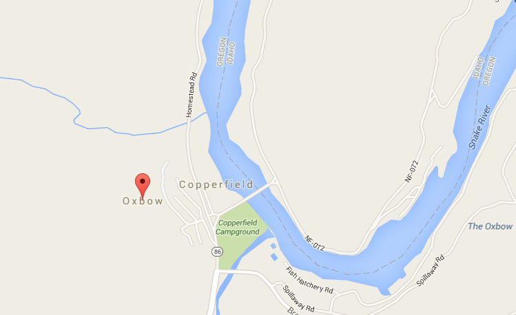
Following the success of getting the best tips from real live people, we asked our young BLM friends at the Oregon Trail site where we should camp in Hells Canyon. They had a bunch of ideas (I took notes), but directed us to a boondocking site just before you cross the bridge at Oxbow.
Oxbow is a very small spot on the map, just on the Oregon side of the Snake River, which divides Oregon (west) from Idaho (east). Boondocking is “wild camping” on unofficial, ungroomed, unmaintained, etc noncampsites. It is FREE and legal – and in
Courtesy of Google Maps
fact encouraged by many public lands, though they usually call it “dispersed camping”. In brochures, on the phone, or best yet face to face at their regional stations, staffers will share with you places for dispersed camping. It’s a bit tough to get the hang of – relying in some cases on only GPS coordinates to find sites, going down a bumpy dirt non-road, not knowing if you can turn around if needed (we have about 40 feet total of vehicles to maneuver.) And, conditions change – there have been so many fires out here – tragic in some cases, just nature running its course in others – that our public servants are doing their best to keep up, and finding us a free place to camp may not be the number one priority, right? But, to circle back, we had the best possible advice and source – from BLM staffers who we’d been chatting with anyway, and were generous enough with their time and insights to help us dip our toes in boondocking.
So – how did we get to our recommended free wild campsite? “Turn left before u cross Oxbow bridge. On reservoir. Tunnel” was all I had in my notes. It actually wasn’t that hard to figure out once we got to Oxbow. If we crossed the bridge, we’d gone too far. Look for a left turn. And a tunnel.The tunnel through a hill of rock was indeed intimidating (to me) but not to Ben. Keep on driving.
Tunnel on way to boondocking site: no problem!
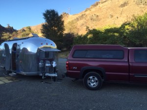
We picked a spot, more of a pullover on a dirt road, indeed overlooking the reservoir, and settled in. When you are a newbie to boondocking you might get a little nervous – Is someone going to tell you to move along? Will your trailer be vandalized? Sure enough, the first other person we saw was a man with a GUN, “just taking his horse out for a ride.” The horse got spooked when he saw his reflection in our trailer. Yep. The second people we saw were two moms with strollers and baby bjorns. OK, we could relax a little.
Our first boondocking site
A view of us in our spot from afar – a little shiny dot!
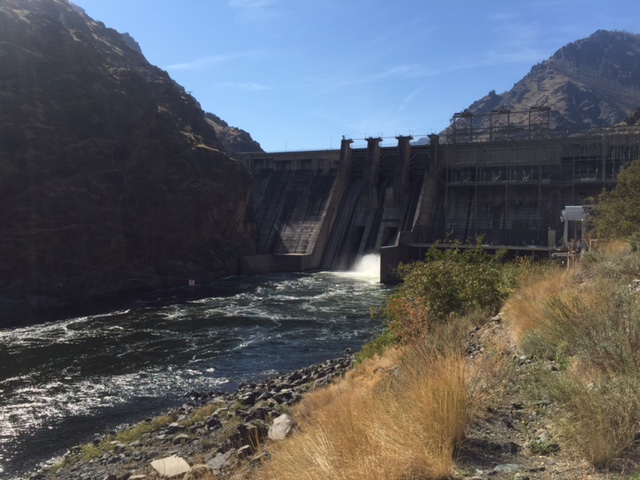
The reservoir we were on was formed from the Snake River and the Hells Canyon Dam – 20 or so miles north and downriver – from our spot. (There are also the Oxbow and Brownlee Dams.) The dams create power of course, and recreation, all governed by Idaho Power. (We barely scratched the surface, but it seems a fascinating intersection of politics, resource management, conservation, and good old boys drinking and fishing. Would love to know more.) It also created a lovely lake-like setting for us to settle in and enjoy the sun as it rose and set across the mountains on both sides (canyon-esque), the birds, the bugs, the jumping fish, and the just-turning fall leaves.
The next day we unhooked – a bit shaky about leaving the trailer in this “unprotected” state but knowing we had a windy road ahead made it easier, and smarter to leave it behind. We crossed the reservoir – we were now in Idaho! A first time in the state for both of us, though this just barely over the border-crossing seemed a bit cheap to count. Passing the dam was incredible – they make it a bit intimidating, like you might have to go through security, though there was none. You realize how valuable dams are, what a target they might be. You don’t have to know much about engineering to be in awe of this.
Hells Canyon Dam
Once we got to the Hells Canyon visitors center, it was a bit of a dead end for us, though just the beginning for those going on jet boat rides and multi-day rafting trips. The road for Chevy Silverados (like ours) literally ends there. There are some nice overlooks, the jet boats, and a nice staffer who told me that most people who explore the Snake do so on multi-day raft trips. The first accessible put out was about 25 miles down river. Amazing.
There is however-and this is a big however- a one mile or so out and back hike along the shoreline which we did and made the trip well worth it. It was so beautiful and like so much on this well timed post-summer season trip-we were the only ones there. We celebrated our two week anniversary as full-timers! A gallery of pics below…I can only imagine what the river and canyon look like beyond this-plan your multi-day rafting trip now!
This slideshow requires JavaScript.
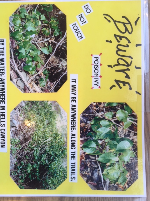
We did have to watch out for poison ivy which I did with my full attention, being super allergic to poison oak. This information saved me, it might save you.
We looked for pictographs and petroglyphs and I thank Hells Canyon for teaching me about what dams do, what reservoirs are, and that there are parts of this country that are “the greatest” but are still very, very wild and not overrun by tourists (like me). I still don’t get what happens to the river – does it just disappear upstream of the dam? Can we make rivers disappear, so it’s easier to go fishing out on our motorboat? Naive city girl, I know.
Back at camp, I went for a swim in the reservoir (a short one). Spent 30 minutes or so watching the show nature was putting on as the sun was setting – a cliche I know, but so accurate. A great show.
Me being still and quiet. Not a joke.
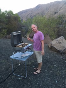
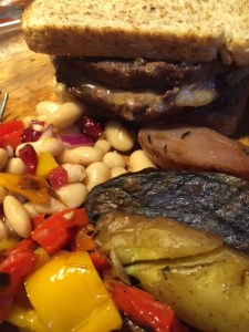
We grilled hamburgers for dinner and made a grilled veggie white bean salad to go with. We thank the Kaufmann’s in Island City, Oregon for the local bread, beef and veggies. Still working on my food photography.
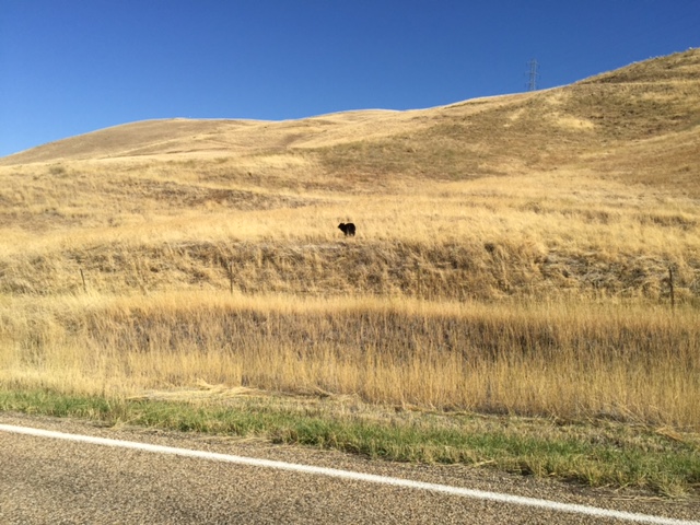
The next day we headed to Boise, the big city, a couple hours southeast. We had one last surprise as we transitioned from the wild to civilization: the little baby bear (below) on the side of the road – perfectly content until he saw us. Luckily we saw him and slowed down and we got to watch him bound away. Blacker than we expected, wide eyed, and very bouncy. Godspeed.
He was only about 20 yards from us when we spotted him. Then bounded away.
From the Fossil Beds, we moseyed east, over to the National Historic Oregon Trail Interpretive Center with the promise of RUTS. Wagon RUTS. From real pioneers. Thousands of them. There are many recommended NPS sites related to the Oregon Trail (thank goodness, right?), but one biggie in our path: the Interpretive Center located near Baker City, Oregon.
Baker City citizens lobbied to have the fancy Center built in their community.
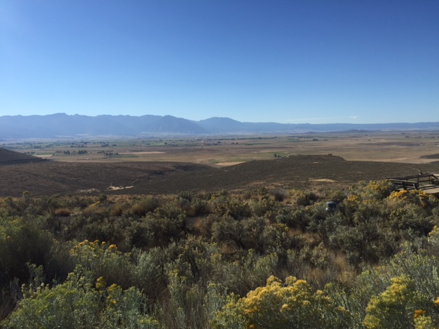
The 10 million dollar center (most locals were quick to either brag or lament the expense) is indeed impressive – high on Flagstaff Hill overlooking the Baker Valley – and the pioneers’ first view of the ominous Blue Mountain range they had to cross, though toward the end (it being Oregon) thankfully, of their journey. Of course the pioneers would not have gone up the hill, they would have gone around it – the easier path. So the high perch of the center itself is designed to give you a view of the trail, not necessarily the view the pioneers themselves would have had. Interesting and smart I thought.
View of Baker Valley and Oregon Trail, including “ruts”, with Blue Mountains in the background. Taken from inside the Interpretive Center. Gorgeous.
Related, when I asked a staffer generally what route the trail took west from the Center, he said “Follow I-84-that was the easiest route than and now.” Logical. So if you want the pioneers’ view, hop on the interstate. : ) If you’d like to learn more from first-hand accounts about this particular spot on the Trail, my brief skim of this guy’s overview and sources seems to square with what we learned at the Center. Fair warning: A lone pine tree meets a grisly end.
The museum displays were the familiar mix of phony/modern/creepy looking mannequins with pained expressions – loss of a child, fear of Indians, uncooperative oxen. Picture Heidi Klum and David Beckham overacting in period costume. (Why didn’t I take pictures???) The building offers a stunning floor to cathedral ceiling windowed-look at the valley – including the RUTS and the rough outlines of what is a mile or so of the Trail (see above picture).
The next section of the museum offered the familiar chronological and contextual panels with many primary sources as well as more than the usual amount of paintings depicting the Trail, which I thought worked well. Lots of audio, and kid-oriented information and activities.
Feminist museum curator sneaks one past the boss!
My takeaways?…I think it did a good job of showing WHO went – eg farmers, not necessarily merchants. Immigrants. People from the midwest, not the east. Young(er). Also, I appreciated they way they broke down the different geographic parts of the trail. I took pride in the fact that most of the detailed first-hand accounts were written by women (see feminist curator’s take on the left). I really appreciated the last section about what happened when they got to Oregon City. What happened next? Right! Thousands of pioneers came over decades. Weren’t the best claims taken in the first month or so? What then? I am still wondering why estimated numbers of emigrants varied so much from year to year – for example in 1850 very few, while in the previous and subsequent years, lots. We stumped the Sunday staffers with our question on that. Anyone?
Though you can hop out of your car and see the RUTS right off the highway on your way out, the staff said we should take the hike down to them – .8 miles there and back through the same sagebrush the pioneers traversed. It was late in the day, and hot, but we booked it, to avoid getting back before closing time.
It didn’t take us quite this long…
Real wagon RUTS, people
Wagon to help get you in the moment
Trail and more RUTS beyond this signpost which reads simply, “Oregon Trail”
It may have colored my “experience” of the RUTS a bit, but I wasn’t overwhelmed with a sense of “x happened right here” that I expected. Maybe it’s just too big an event to get that feeling about. Maybe it was the unseasonably hot weather and the prospect of a mile hike back up the hill. Our water and peanut M&M supply was low. I don’t take this lightly as I am a big believer in the power of “being there” to help you understand history. Nothing alarming, just a little twist on the power, which I will continue to drill down on. Still overall, a really cool place and way to learn about it.
Some young BLM staffers were out front giving a flint knapping demonstration. It’s sort of like knitting we were told (in that it’s repetitive and meditative), but very dangerous as you are using a flint to carve a seemingly impenetrable rock into an arrowhead.
The guy doing the demo said there was an old Indian who came out of the mountains in 19-oh something, and became a sort of artist in residence at a museum in San Francisco, and it’s because of that old Indian that anyone alive today knows anything about flint knapping. Hmm. We asked his wife, who was sitting nearby, if she had any dangerous hobbies, and she said camping, so we quizzed them on places to camp as we headed toward Idaho. Score. See upcoming post on Hells Canyon.
So, just to add some authenticity to this experience, we had our own little pioneer mishap with our trailer’s tongue jack (see similar: tall thin cylindrical thing in the middle with a handle in the pic at right) when we were leaving our campsite that morning. Let’s just say the tongue jack (and trailer) is 50 years old. While Ben was turning it (thank god for the laws of physics) to lift the 4,200 pound trailer so we could place it on the truck’s hitch, it slipped, again, and again. Damn, physics. I of course screamed and
Photo credit: vintageairstream.com
called (not literally as there was no cell service) for AAA, then took a walk, at Ben’s request. He in the meantime pulled out two other jacks (for the car) and placed some legos (not really, but sort of) between one and the trailer tongue, so he could lift it high enough to get it on the truck. There were some rope harnesses involved as well. Sorry, Ben would have killed me if I took an actual picture of it. So we have a new tongue jack, an electric one. Take that pioneers! Off we go to Hells Canyon, then Idaho, a reverse migration?
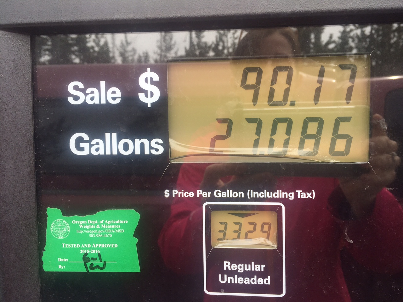
We turned off the road to head to Crater Lake – the only National Park in Oregon and a site we might have skipped if not for friends’ recommendations – with less than a 1/4 tank of gas and no reservation. We hoped to stay IN the park-its campground is the closest to the lake, making access easy. But I was nervous-what if the campground was full? Our M.O. of making plans one day ahead of time does not square with the park’s online reservation system that you plan at least (a shocking) two days ahead of time. Plus-gas! We’ve been averaging 11.5 miles a gallon. Ugh.
We’ve been logging our mileage/fuel costs – biggest expense so far especially as we’ve been making tracks.
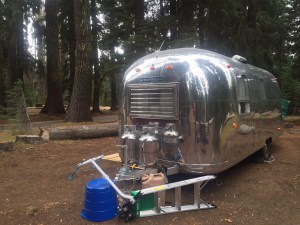
We zoomed past the entrance with our national park Golden Eagle pass (a bon voyage gift from Ben and Joan – merci!) straight to the kiosk for walk ins. Score! Campsites available plus… gas pumps, located on site! We did our circle the campground loops thing, picking out the best site and chose D loop, site 13, overlooking a lovely gorge. Temps were cold – snow / rain was in the forecast.
This is our fourth campground, and though our carefully posed photos of the others might suggest otherwise, this is the first one that really made us go WOW.
Maybe it’s the time of year – not too crowded, summer fading – but the forest is lovely, the chipmunks camera ready, and the sites were (all?) pull through rather than back in which we hadn’t seen yet. And I guess really – and this is maybe connected to it being a national park – no road noise, far from “civilization”.
Switching out and into our cold weather wardrobe.
Doesn’t show how cold it GOT, but a stark contrast from California
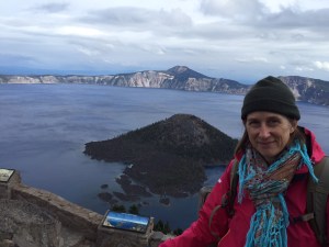
Your first view of the lake is breathtaking – clear, blue, vast.
We did a ranger talk, a hike, and the rim drive – about 22 miles.
I heard that the best things to note in a travel journal, or in photos, are the things you want to remember.
Things we want to remember about Crater Lake:
Ben: The park ranger, in his talk had us picture the people living in this area when the volcano blew – imagine your whole life a 12,000 foot mountain is a part of your landscape. Then one day – in less than 12 hours – it was gone, replaced with a 2000 foot crater (or more accurately a caldera.)
Ranger talk. Always entertaining.
The volcano within the caldera.
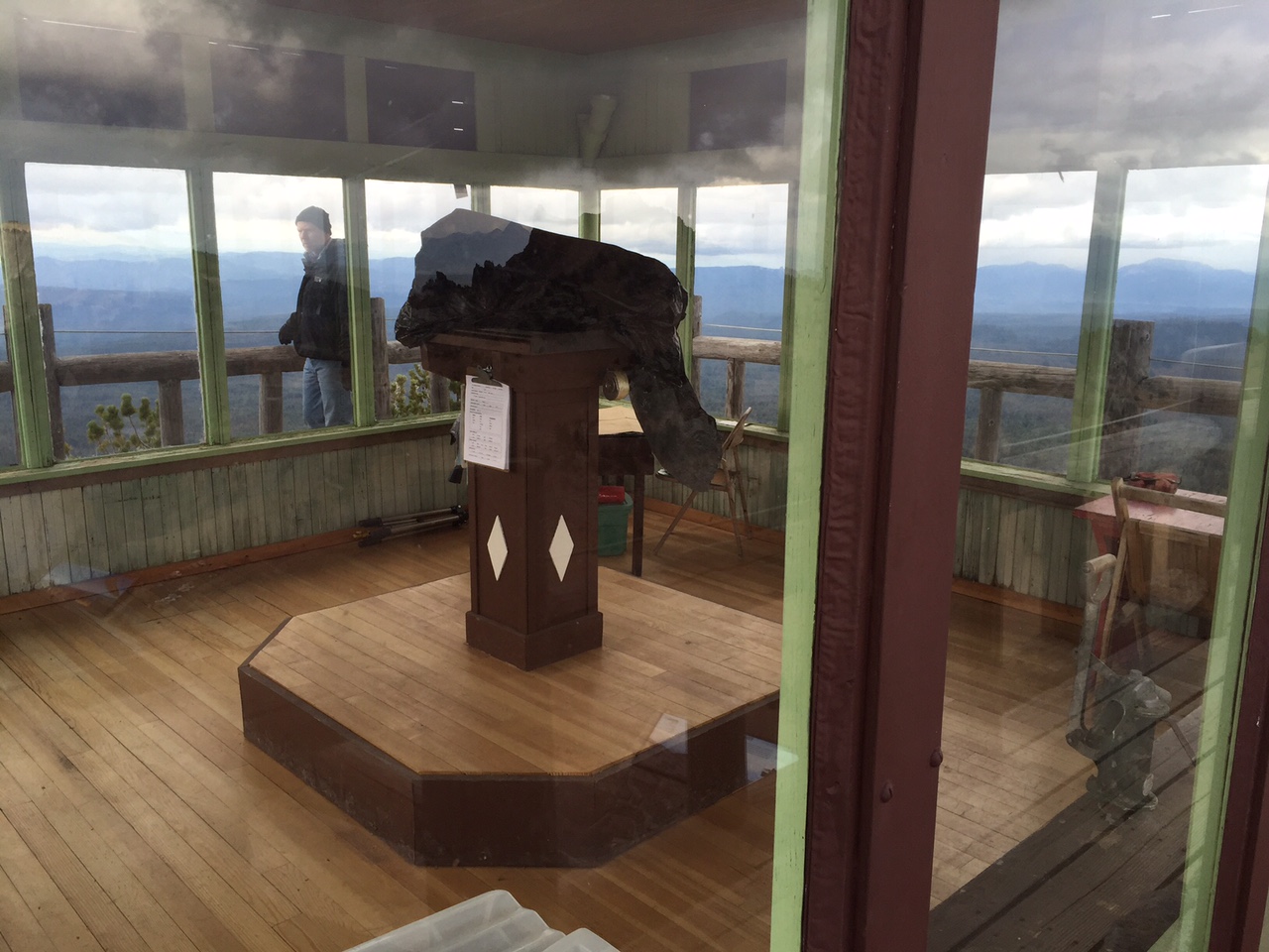
Meg: The hike up Watchman – where there is a national landmark fire watching station – still used today. With key supplies like a pencil, pencil sharpener and glass cleaner.
Firewatching station up watchman hill.
There were actually fires in the distance too – set by lightening, watched and controlled by firefighters. Naturally occurring fire (lightning), that doesn’t threaten human property or people, is an important part of the natural process and is allowed to burn.
At the top of the Watchman – where firefighters still look out and have been since the 30s.
We had such a great day – and a night of freezing temps as we were still missing a few parts to get the propane heater warmed up. Our gas stove warmed things up a bit and wool blankets too. Ben’s fingers nearly froze hooking up the trailer to leave in the morning.
Snow on our way out of Crater Lake the next day. ZERO visibility.
Doesn’t hurt to celebrate an anniversary – and I’m currently typing/posting this while doing another FIRST: Laundry! Woot!
One last pic of the lake – they call it the phantom ship. Lovely. Like a little Airstream!


 Ashland Co-op and scout out restaurants for before a concert we were heading to that night. As we winded down this first leg of our trip, it seemed we still had some work to do to check out the night life / cultural events in the places we visited. This (left) folks/bluegrass/orchestral mix of groups was right up our alley. They even had a hammer dulcimer! One of the leads, Emy Phelps, is from Ashland, so it was a homecoming event for her. A highlight was when they brought all the local (about 20 kids) young violin students up on stage with them to join in for one of Emy’s songs. The parents especially loved that because all those hardworking novices sounded so good in harmony with the professionals. The whole vibe was about collaboration and education, a mix of young and older, lots of smiles and great music! Culture and nightlife – check!